Area Overview for ST15 0HP
Photos of ST15 0HP
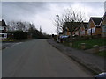
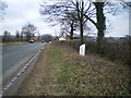
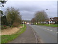
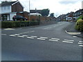
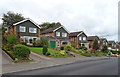
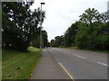
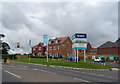
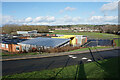
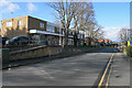
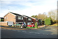
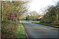
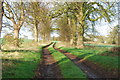
17 photos from this area
Area Information
Key information about the ST15 0HP including its size, population, and administrative classification.
- Area Type
- Postcode
- Area Size
- 1.3 hectares
- Population
- 1987
- Population Density
- 2610 people/km²
House Prices in ST15 0HP
17
Properties
£258,222
Average Sold Price
£119,000
Lowest Price
£400,000
Highest Price
Showing 17 properties
| Address | Type | Beds | Baths | Last Sale Price | Last Sale Date | |
|---|---|---|---|---|---|---|
| 78 Bank Side, Walton, Stone, ST15 0HP | Semi-detached | 3 | 1 | £300,000 | Feb 2023 | |
| 94 Bank Side, Walton, Stone, ST15 0HP | house | - | - | £400,000 | Jul 2022 | |
| 88 Bank Side, Walton, Stone, ST15 0HP | house | - | - | £220,000 | Aug 2019 | |
| 91 Bank Side, Walton, Stone, ST15 0HP | house | - | - | £354,000 | Sep 2015 | |
| 72 Bank Side, Walton, Stone, ST15 0HP | Detached | 3 | 1 | £195,000 | Jan 2015 | |
| 92 Bank Side, Walton, Stone, ST15 0HP | house | - | - | £240,000 | Dec 2009 | |
| 89 Bank Side, Walton, Stone, ST15 0HP | Detached | - | - | £370,000 | Jul 2007 | |
| 70 Bank Side, Walton, Stone, ST15 0HP | Detached | - | - | £119,000 | Apr 2002 | |
| 82 Bank Side, Walton, Stone, ST15 0HP | Detached | - | - | £126,000 | Jan 2002 | |
| 76 Bank Side, Walton, Stone, ST15 0HP | Detached | 4 | 1 | - | - |
Page 1 of 2
Energy Efficiency in ST15 0HP
Amenities
Schools
| Rank | School | Type | Entry gender | Ages |
|---|
Explore more schools in this area
Go to Schools tabDemographics
Household Size
Two person
most common
Accommodation Type
Houses
most common
Tenure
71
majority
Ethnic Group
White
most common
Religion
N/A
most common
Household Composition
N/A
most common
Age
47
median
Adults (30-64 years)
most common
Household Deprivation
N/A
with no deprivation
NS-SEC
38
in Lower managerial occupations
Explore more demographic insights in this area
Go to Demographics tabPlanning
Planning Constraints
- Flood RiskPremium
- Ramsar Wetland SitesPremium
- Area of Outstanding Natural BeautyPremium
- Protected Nature ReservePremium
- Protected WoodlandPremium