Area Overview for ST15 0FU
Photos of ST15 0FU
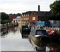
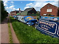
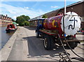
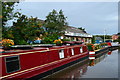
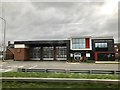
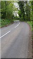
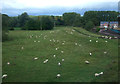
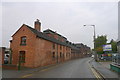
51 photos from this area
Area Information
Key information about the ST15 0FU including its size, population, and administrative classification.
- Area Type
- Postcode
- Area Size
- 2.6 hectares
- Population
- 1987
- Population Density
- 2610 people/km²
House Prices in ST15 0FU
58
Properties
£329,967
Average Sold Price
£133,000
Lowest Price
£711,600
Highest Price
Showing 58 properties
| Address | Type | Beds | Baths | Last Sale Price | Last Sale Date | |
|---|---|---|---|---|---|---|
| 44 Brassington Road, Stone, ST15 0FU | Detached | 4 | 2 | £410,000 | Sep 2025 | |
| 14 Brassington Road, Stone, ST15 0FU | house | - | - | £215,000 | Apr 2025 | |
| 8 Brassington Road, Stone, ST15 0FU | Detached | 4 | 3 | £340,000 | Mar 2025 | |
| 23 Brassington Road, Stone, ST15 0FU | house | - | - | £290,000 | Mar 2025 | |
| 41 Brassington Road, Stone, ST15 0FU | house | - | - | £405,000 | Mar 2025 | |
| 12 Brassington Road, Stone, ST15 0FU | Detached | 4 | 3 | £295,000 | Feb 2025 | |
| 31 Brassington Road, Stone, ST15 0FU | house | - | - | £430,000 | Feb 2025 | |
| 17 Brassington Road, Stone, ST15 0FU | house | - | - | £450,000 | Feb 2025 | |
| 19 Brassington Road, Stone, ST15 0FU | house | - | - | £365,000 | Feb 2025 | |
| 37 Brassington Road, Stone, ST15 0FU | house | - | - | £295,000 | Dec 2024 |
Page 1 of 6
Energy Efficiency in ST15 0FU
Amenities
Schools
| Rank | School | Type | Entry gender | Ages |
|---|
Explore more schools in this area
Go to Schools tabDemographics
Household Size
Two person
most common
Accommodation Type
Houses
most common
Tenure
71
majority
Ethnic Group
White
most common
Religion
N/A
most common
Household Composition
N/A
most common
Age
47
median
Adults (30-64 years)
most common
Household Deprivation
N/A
with no deprivation
NS-SEC
38
in Lower managerial occupations
Explore more demographic insights in this area
Go to Demographics tabPlanning
Planning Constraints
- Flood RiskPremium
- Ramsar Wetland SitesPremium
- Area of Outstanding Natural BeautyPremium
- Protected Nature ReservePremium
- Protected WoodlandPremium