Area Overview for ST15 0FR
Photos of ST15 0FR
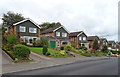
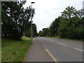
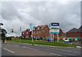
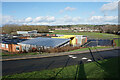
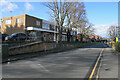
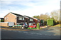
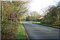
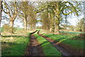
17 photos from this area
Area Information
Key information about the ST15 0FR including its size, population, and administrative classification.
- Area Type
- Postcode
- Area Size
- 1.5 hectares
- Population
- 1987
- Population Density
- 2610 people/km²
House Prices in ST15 0FR
37
Properties
£253,105
Average Sold Price
£133,000
Lowest Price
£575,210
Highest Price
Showing 37 properties
| Address | Type | Beds | Baths | Last Sale Price | Last Sale Date | |
|---|---|---|---|---|---|---|
| 32 Lockley Walk, Walton, Stone, ST15 0FR | Terraced | 3 | 2 | £226,000 | May 2024 | |
| 34 Lockley Walk, Walton, Stone, ST15 0FR | Terraced | 3 | 2 | £227,500 | Oct 2023 | |
| 33 Lockley Walk, Walton, Stone, ST15 0FR | house | - | - | £187,000 | Sep 2020 | |
| 36 Lockley Walk, Walton, Stone, ST15 0FR | house | - | - | £229,950 | Jun 2020 | |
| 2 Lockley Walk, Walton, Stone, ST15 0FR | house | - | - | £249,950 | Jun 2020 | |
| 17 Lockley Walk, Walton, Stone, ST15 0FR | house | - | - | £239,950 | May 2020 | |
| 35 Lockley Walk, Walton, Stone, ST15 0FR | house | - | - | £229,950 | Dec 2019 | |
| 10 Lockley Walk, Walton, Stone, ST15 0FR | house | - | - | £355,800 | Dec 2019 | |
| 14 Lockley Walk, Walton, Stone, ST15 0FR | house | - | - | £133,000 | Dec 2019 | |
| 15 Lockley Walk, Walton, Stone, ST15 0FR | house | - | - | £133,000 | Dec 2019 |
Page 1 of 4
Energy Efficiency in ST15 0FR
Amenities
Schools
| Rank | School | Type | Entry gender | Ages |
|---|
Explore more schools in this area
Go to Schools tabDemographics
Household Size
Two person
most common
Accommodation Type
Houses
most common
Tenure
71
majority
Ethnic Group
White
most common
Religion
N/A
most common
Household Composition
N/A
most common
Age
47
median
Adults (30-64 years)
most common
Household Deprivation
N/A
with no deprivation
NS-SEC
38
in Lower managerial occupations
Explore more demographic insights in this area
Go to Demographics tabPlanning
Planning Constraints
- Flood RiskPremium
- Ramsar Wetland SitesPremium
- Area of Outstanding Natural BeautyPremium
- Protected Nature ReservePremium
- Protected WoodlandPremium