Area Overview for ST15 0EB
Photos of ST15 0EB
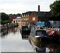
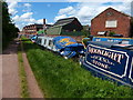
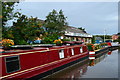
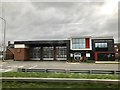
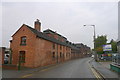

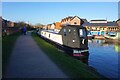
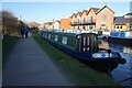

51 photos from this area
Area Information
Key information about the ST15 0EB including its size, population, and administrative classification.
- Area Type
- Postcode
- Area Size
- 9740 m²
- Population
- 1930
- Population Density
- 2389 people/km²
House Prices in ST15 0EB
33
Properties
£97,337
Average Sold Price
£22,000
Lowest Price
£202,500
Highest Price
Showing 33 properties
| Address | Type | Beds | Baths | Last Sale Price | Last Sale Date | |
|---|---|---|---|---|---|---|
| 7 Churchill Road, Stone, ST15 0EB | Flat | 1 | 1 | £78,000 | Jul 2025 | |
| 53 Churchill Road, Stone, ST15 0EB | Terraced | 3 | 1 | £160,000 | Apr 2024 | |
| 45 Churchill Road, Stone, ST15 0EB | Terraced | 3 | 1 | £202,500 | Aug 2023 | |
| 17 Churchill Road, Stone, ST15 0EB | Semi-detached | 4 | 1 | £155,000 | Aug 2020 | |
| 35 Churchill Road, Stone, ST15 0EB | Flat | 4 | 2 | £160,000 | Oct 2018 | |
| 31 Churchill Road, Stone, ST15 0EB | Terraced | 3 | 1 | £150,000 | Mar 2018 | |
| 15 Churchill Road, Stone, ST15 0EB | Terraced | 3 | 1 | £150,000 | Jun 2016 | |
| 3 Churchill Road, Stone, ST15 0EB | Flat | - | - | £62,000 | Sep 2013 | |
| 7A Churchill Road, Stone, ST15 0EB | Flat | 2 | 1 | £86,000 | May 2008 | |
| 11 Churchill Road, Stone, ST15 0EB | Flat | - | - | £74,000 | Mar 2008 |
Page 1 of 4
Energy Efficiency in ST15 0EB
Amenities
Schools
| Rank | School | Type | Entry gender | Ages |
|---|
Explore more schools in this area
Go to Schools tabDemographics
Household Size
One person
most common
Accommodation Type
Houses
most common
Tenure
66
majority
Ethnic Group
White
most common
Religion
N/A
most common
Household Composition
N/A
most common
Age
47
median
Adults (30-64 years)
most common
Household Deprivation
N/A
with no deprivation
NS-SEC
31
in Lower managerial occupations
Explore more demographic insights in this area
Go to Demographics tabPlanning
Planning Constraints
- Flood RiskPremium
- Ramsar Wetland SitesPremium
- Area of Outstanding Natural BeautyPremium
- Protected Nature ReservePremium
- Protected WoodlandPremium