Area Overview for ST13 8LQ
Photos of ST13 8LQ


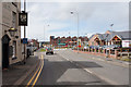


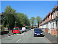
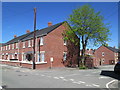
100 photos from this area
Area Information
Key information about the ST13 8LQ including its size, population, and administrative classification.
- Area Type
- Postcode
- Area Size
- 1.7 hectares
- Population
- 1597
- Population Density
- 3078 people/km²
House Prices in ST13 8LQ
22
Properties
£119,977
Average Sold Price
£18,750
Lowest Price
£250,000
Highest Price
Showing 22 properties
| Address | Type | Beds | Baths | Last Sale Price | Last Sale Date | |
|---|---|---|---|---|---|---|
| 21 Kiln Lane, Leek, ST13 8LQ | Semi-detached | 3 | 2 | £185,000 | Mar 2024 | |
| 5 Kiln Lane, Leek, ST13 8LQ | Flat | 1 | 1 | £65,000 | Jul 2023 | |
| Rudyard View, Kiln Lane, Leek, ST13 8LQ | Detached | 3 | 2 | £250,000 | Oct 2021 | |
| 6 Kiln Lane, Leek, ST13 8LQ | house | - | - | £34,000 | May 2021 | |
| 24 Kiln Lane, Leek, ST13 8LQ | Cottage | 2 | 1 | £166,000 | Sep 2019 | |
| 32 Kiln Lane, Leek, ST13 8LQ | Bungalow | 2 | - | £125,000 | Dec 2017 | |
| 28 Kiln Lane, Leek, ST13 8LQ | Cottage | 2 | 1 | £129,000 | Nov 2016 | |
| 26 Kiln Lane, Leek, ST13 8LQ | Cottage | 1 | 1 | £123,000 | Mar 2015 | |
| 34 Kiln Lane, Leek, ST13 8LQ | Detached | 3 | 1 | £155,000 | Mar 2014 | |
| 5A Kiln Lane, Leek, ST13 8LQ | Bungalow | 2 | - | £18,750 | Aug 2001 |
Page 1 of 3
Energy Efficiency in ST13 8LQ
Amenities
Schools
| Rank | School | Type | Entry gender | Ages |
|---|
Explore more schools in this area
Go to Schools tabDemographics
Household Size
One person
most common
Accommodation Type
Houses
most common
Tenure
69
majority
Ethnic Group
White
most common
Religion
N/A
most common
Household Composition
N/A
most common
Age
47
median
Adults (30-64 years)
most common
Household Deprivation
N/A
with no deprivation
NS-SEC
32
in Lower managerial occupations
Explore more demographic insights in this area
Go to Demographics tabPlanning
Planning Constraints
- Flood RiskPremium
- Ramsar Wetland SitesPremium
- Area of Outstanding Natural BeautyPremium
- Protected Nature ReservePremium
- Protected WoodlandPremium