Area Overview for ST13 8BG
Photos of ST13 8BG
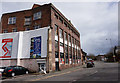
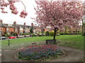
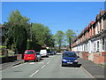
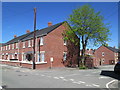
100 photos from this area
Area Information
Key information about the ST13 8BG including its size, population, and administrative classification.
- Area Type
- Postcode
- Area Size
- 7562 m²
- Population
- 1511
- Population Density
- 3989 people/km²
House Prices in ST13 8BG
32
Properties
£112,825
Average Sold Price
£36,750
Lowest Price
£185,000
Highest Price
Showing 32 properties
| Address | Type | Beds | Baths | Last Sale Price | Last Sale Date | |
|---|---|---|---|---|---|---|
| 13 Shirley Street, Leek, ST13 8BG | Terraced | 3 | 1 | £185,000 | Jan 2023 | |
| 15 Shirley Street, Leek, ST13 8BG | Semi-detached | 3 | 1 | £110,000 | Aug 2022 | |
| 53 Shirley Street, Leek, ST13 8BG | Terraced | 3 | 2 | £170,000 | May 2022 | |
| 29 Shirley Street, Leek, ST13 8BG | Terraced | 3 | 1 | £150,000 | Mar 2021 | |
| 55 Shirley Street, Leek, ST13 8BG | house | - | - | £140,750 | Sep 2020 | |
| 24 Shirley Street, Leek, ST13 8BG | Semi-detached | 3 | 1 | £167,500 | Jul 2020 | |
| 25 Shirley Street, Leek, ST13 8BG | Terraced | 2 | 1 | £125,000 | Feb 2020 | |
| 47 Shirley Street, Leek, ST13 8BG | Terraced | 2 | 1 | £155,000 | Aug 2019 | |
| Westholme, 20 Shirley Street, Leek, ST13 8BG | Semi-detached | 3 | 1 | £139,000 | Jun 2019 | |
| 31 Shirley Street, Leek, ST13 8BG | Semi-detached | 3 | 1 | £129,995 | Mar 2019 |
Page 1 of 4
Energy Efficiency in ST13 8BG
Amenities
Schools
| Rank | School | Type | Entry gender | Ages |
|---|
Explore more schools in this area
Go to Schools tabDemographics
Household Size
Family (3-5 people)
most common
Accommodation Type
Houses
most common
Tenure
68
majority
Ethnic Group
White
most common
Religion
N/A
most common
Household Composition
N/A
most common
Age
47
median
Adults (30-64 years)
most common
Household Deprivation
N/A
with no deprivation
NS-SEC
26
in Lower managerial occupations
Explore more demographic insights in this area
Go to Demographics tabPlanning
Planning Constraints
- Flood RiskPremium
- Ramsar Wetland SitesPremium
- Area of Outstanding Natural BeautyPremium
- Protected Nature ReservePremium
- Protected WoodlandPremium