Area Overview for ST11 9BP
Photos of ST11 9BP
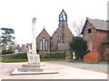
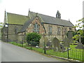
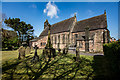
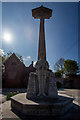
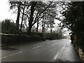

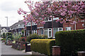
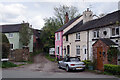
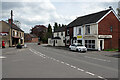
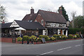
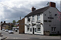
21 photos from this area
Area Information
Key information about the ST11 9BP including its size, population, and administrative classification.
- Area Type
- Postcode
- Area Size
- 1.6 hectares
- Population
- 1836
- Population Density
- 469 people/km²
House Prices in ST11 9BP
22
Properties
£135,700
Average Sold Price
£58,800
Lowest Price
£215,000
Highest Price
Showing 22 properties
| Address | Type | Beds | Baths | Last Sale Price | Last Sale Date | |
|---|---|---|---|---|---|---|
| 14 Churnet Road, Forsbrook, ST11 9BP | Retail | 3 | 1 | £215,000 | Apr 2025 | |
| Augusta, 2 Churnet Road, Forsbrook, ST11 9BP | Semi-detached | 3 | 1 | £150,000 | Dec 2015 | |
| 17 Churnet Road, Forsbrook, ST11 9BP | house | - | - | £127,000 | Jun 2010 | |
| 10 Churnet Road, Forsbrook, ST11 9BP | Semi-detached | - | - | £130,000 | Aug 2009 | |
| 5 Churnet Road, Forsbrook, ST11 9BP | Semi-detached | - | - | £170,000 | Jul 2007 | |
| 9 Churnet Road, Forsbrook, ST11 9BP | house | - | - | £128,500 | Aug 2006 | |
| 6 Churnet Road, Forsbrook, ST11 9BP | Semi-detached | 3 | 1 | £130,000 | Oct 2005 | |
| 13 Churnet Road, Forsbrook, ST11 9BP | Terraced | - | - | £112,000 | May 2004 | |
| 8 Churnet Road, Forsbrook, ST11 9BP | Semi-detached | 3 | 1 | £58,800 | May 2000 | |
| 22 Churnet Road, Forsbrook, ST11 9BP | Detached | 3 | 1 | - | - |
Page 1 of 3
Energy Efficiency in ST11 9BP
Amenities
Schools
| Rank | School | Type | Entry gender | Ages |
|---|
Explore more schools in this area
Go to Schools tabDemographics
Household Size
Two person
most common
Accommodation Type
Houses
most common
Tenure
90
majority
Ethnic Group
White
most common
Religion
N/A
most common
Household Composition
N/A
most common
Age
47
median
Adults (30-64 years)
most common
Household Deprivation
N/A
with no deprivation
NS-SEC
32
in Lower managerial occupations
Explore more demographic insights in this area
Go to Demographics tabPlanning
Planning Constraints
- Flood RiskPremium
- Ramsar Wetland SitesPremium
- Area of Outstanding Natural BeautyPremium
- Protected Nature ReservePremium
- Protected WoodlandPremium