Area Overview for Telford
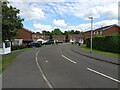
Photos of Telford


Area Information
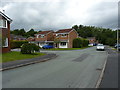
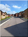
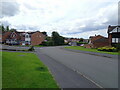
Telford stands as a distinct built-up area within England, covering 52.3 km². The town accommodates a population of 15,043, resulting in a moderate density of 288 people per square kilometre. This established community offers a balance between residential space and local access, typical of a well-maintained town environment. Living in Telford provides residents with proximity to key local services while retaining a manageable urban footprint. You will find a community where daily life revolves around local neighbourhoods rather than sprawling metropolitan development. The area functions effectively as a hub for those seeking established housing without the scale of a major city centre. As you navigate the streets, you encounter a landscape defined by its residential focus and structured town planning. The town represents a practical choice for homebuyers who value a defined local identity over the anonymity of larger urban centres. Your daily routine benefits from the town's compact nature, ensuring that essential needs are within easy reach without requiring extensive travel. ### The people of Telford display a clear demographic profile that influences the community atmosphere. The median age in the area is 70 years old, indicating a population skewed significantly towards older residents. Most data regarding household composition and accommodation types is aggregated under total figures, yet the age profile suggests a senior-heavy neighbourhood. You must consider what this longevity implies for local service demand and social dynamics. Home ownership stands at a solid 60%, marking a substantial proportion of residents as landlords of their own properties. This high ownership rate typically stabilises the community and reduces transient population turnover. The town lacks specific broken-down data on predominant ethnic groups or religious make-up, but the age statistics remain a defining characteristic. Families may find the vibrant energy of a younger demographic less common here compared to other areas. Instead, you will engage with a mature community where many inhabitants have lived for decades. Understanding this age structure helps you anticipate the pace of life and the nature of neighbourly interactions you will experience when moving here. ### The housing landscape in Telford reflects a traditional residential focus rather than a high-density rental market. A full 60% of residents own their homes, suggesting the local stock is heavily weighted towards owner-occupied properties. This statistic indicates stability within the market, as owner-occupiers tend to remain in their homes for longer periods. You are likely to find established houses and bungalows suited to an older demographic, rather than transient student housing or purpose-built high-rise apartments. The 52.3 km² size of the area allows for varied housing stock, though the high ownership rate points towards suburban or urban residential zones. When viewing homes in Telford, expect a market driven by people seeking to settle down rather than investors flipping properties quickly. The moderate population density of 288 people per square kilometre often correlates with detached or semi-detached housing. This environment suits those who prefer privacy and a traditional English suburban lifestyle. Rental properties may be less common compared to owner-occupied dwellings, narrowing your search criteria if you are not planning to buy immediately. ### Families considering schools near Telford have several local options listed within the immediate area. Short Wood Primary School operates as a primary institution and holds a good Ofsted rating, providing a recognised standard of education for younger children. You will also find Madeley Nursery School and Oakengates Nursery School, which offer early years care for infants before they reach primary age. Another option is St Leonard's Infant School, another primary-level establishment serving the local community. The Linden Centre is listed as well, though its classification is marked as other rather than a standard nursery or primary school. This specific selection of facilities means you have access to both nursery and primary education without needing to travel far. The presence of a primary school with a good rating suggests that the area meets regulatory standards for education quality. While secondary education is not listed in the provided data, these local institutions form the foundation of the town's educational provision for young families living in Telford. ### Digital connectivity in Telford sets a high standard for remote working and online access. The fixed broadband quality score reaches 92 out of 100, placing the area in the excellent category for internet speeds and reliability. You can stream, work, and connect online with minimal interruption, making this location suitable for professionals who work from home. Mobile coverage scores 81 out of 100, indicating excellent performance on the 0 to 100 quality scale. Signal strength here is robust enough to support video calls and mobile-heavy tasks throughout the town centre. For residents, this means reliable high-speed internet without the frustration of frequent dropouts. Retail and rail connectivity further enhances the area's accessibility. You can travel to major destinations via Oakengates Railway Station, Telford Central Railway Station, or Wellington Railway Station. Sainsburys Telford and Co-op Telford provide essential shopping within easy reach, while Farmfoods Overdale offers another convenient option for groceries. These transport links and digital infrastructure combine to create a functional living environment that supports both daily errands and modern work requirements. ### Daily life in Telford offers straightforward access to essential amenities within practical reach. Five notable retail outlets serve the town, including Sainsburys Telford, Co-op Telford, and Farmfoods Overdale. These supermarkets ensure you can buy food and household goods without travelling far. The town is also served by four railway stations, including Oakengates Railway Station, Telford Central Railway Station, and Wellington Railway Station. This rail network connects you to wider regional travel options efficiently. You can expect a lifestyle centred on convenience rather than extensive leisure facilities or high-end dining, as the listed amenities focus on retail and transport. The area's 15,043 residents contribute to a community atmosphere that is active but not overwhelmingly crowded. Living in Telford means prioritising utility and accessibility. While the town lacks the cultural venues of a major city, the reliable presence of key shops and train stations meets the core needs of most households. Your weekends will be defined by local convenience and the ease of getting out when necessary. ### Safety in Telford presents a balanced picture that requires standard precautions. The crime risk assessment assigns the area a warning level, indicating that crime rates are around the average for similar locations. A safety score of 61 out of 100 falls within the medium risk category, where lower scores denote less risk. You should not expect zero incidents, but the situation is not alarmist. Standard security measures are advisable when walking around the area or securing your home. This level of risk is typical for many built-up areas and residents can live normally without excessive fear. The assessment highlights that while vigilance is prudent, the town is not a high-crime zone requiring special fears. Environmental conditions generally support a safe community living experience for the 15,043 residents. You can walk in many parts of the town with the assurance that crime is not a dominant daily concern. Living in Telford involves maintaining normal safety habits found in towns across the country. ### Who is the typical resident of Telford?The typical resident is an older adult, with a median age of 70 and a most common age range of total. Sixty percent of residents own their homes, pointing towards a stable, owner-occupied community of homeowners rather than renters or students. What schools are available for my children in Telford?Local options include Short Wood Primary School, which has a good Ofsted rating, and St Leonard's Infant School. Parents can also find care at Madeley Nursery School and Oakengates Nursery School, providing a complete range of early years and primary education within the town. Is internet and transport reliable in Telford?Connectivity is excellent. Fixed broadband scores 92/100 and mobile coverage scores 81/100, making it ideal for remote work. Transport is equally strong, with four stations including Telford Central and Oakengates providing easy access to wider travel networks. How safe is it to live in Telford?Telford has a medium crime risk with a safety score of 61/100. Crime rates are around average, so while standard security precautions are advisable, the area is not considered high-risk and offers a generally safe environment for daily life. What shops and amenities can I access locally?Residents have convenient access to five retail locations, specifically Sainsburys Telford, Co-op Telford, and Farmfoods Overdale. Supermarkets and transport hubs are situated within practical reach, ensuring that daily shopping and commuting needs are easily met.
- Area Type
- Built Up Area 250
- Area Size
- 52.3 km²
- Population
- 15043
- Population Density
- 288 people/km²
Daily life in Telford offers straightforward access to essential amenities within practical reach. Five notable retail outlets serve the town, including Sainsburys Telford, Co-op Telford, and Farmfoods Overdale. These supermarkets ensure you can buy food and household goods without travelling far. The town is also served by four railway stations, including Oakengates Railway Station, Telford Central Railway Station, and Wellington Railway Station. This rail network connects you to wider regional travel options efficiently. You can expect a lifestyle centred on convenience rather than extensive leisure facilities or high-end dining, as the listed amenities focus on retail and transport. The area's 15,043 residents contribute to a community atmosphere that is active but not overwhelmingly crowded. Living in Telford means prioritising utility and accessibility. While the town lacks the cultural venues of a major city, the reliable presence of key shops and train stations meets the core needs of most households. Your weekends will be defined by local convenience and the ease of getting out when necessary. ### Safety in Telford presents a balanced picture that requires standard precautions. The crime risk assessment assigns the area a warning level, indicating that crime rates are around the average for similar locations. A safety score of 61 out of 100 falls within the medium risk category, where lower scores denote less risk. You should not expect zero incidents, but the situation is not alarmist. Standard security measures are advisable when walking around the area or securing your home. This level of risk is typical for many built-up areas and residents can live normally without excessive fear. The assessment highlights that while vigilance is prudent, the town is not a high-crime zone requiring special fears. Environmental conditions generally support a safe community living experience for the 15,043 residents. You can walk in many parts of the town with the assurance that crime is not a dominant daily concern. Living in Telford involves maintaining normal safety habits found in towns across the country. ### Who is the typical resident of Telford?The typical resident is an older adult, with a median age of 70 and a most common age range of total. Sixty percent of residents own their homes, pointing towards a stable, owner-occupied community of homeowners rather than renters or students. What schools are available for my children in Telford?Local options include Short Wood Primary School, which has a good Ofsted rating, and St Leonard's Infant School. Parents can also find care at Madeley Nursery School and Oakengates Nursery School, providing a complete range of early years and primary education within the town. Is internet and transport reliable in Telford?Connectivity is excellent. Fixed broadband scores 92/100 and mobile coverage scores 81/100, making it ideal for remote work. Transport is equally strong, with four stations including Telford Central and Oakengates providing easy access to wider travel networks. How safe is it to live in Telford?Telford has a medium crime risk with a safety score of 61/100. Crime rates are around average, so while standard security precautions are advisable, the area is not considered high-risk and offers a generally safe environment for daily life. What shops and amenities can I access locally?Residents have convenient access to five retail locations, specifically Sainsburys Telford, Co-op Telford, and Farmfoods Overdale. Supermarkets and transport hubs are situated within practical reach, ensuring that daily shopping and commuting needs are easily met.
Amenities
Schools
Families considering schools near Telford have several local options listed within the immediate area. Short Wood Primary School operates as a primary institution and holds a good Ofsted rating, providing a recognised standard of education for younger children. You will also find Madeley Nursery School and Oakengates Nursery School, which offer early years care for infants before they reach primary age. Another option is St Leonard's Infant School, another primary-level establishment serving the local community. The Linden Centre is listed as well, though its classification is marked as other rather than a standard nursery or primary school. This specific selection of facilities means you have access to both nursery and primary education without needing to travel far. The presence of a primary school with a good rating suggests that the area meets regulatory standards for education quality. While secondary education is not listed in the provided data, these local institutions form the foundation of the town's educational provision for young families living in Telford. ### Digital connectivity in Telford sets a high standard for remote working and online access. The fixed broadband quality score reaches 92 out of 100, placing the area in the excellent category for internet speeds and reliability. You can stream, work, and connect online with minimal interruption, making this location suitable for professionals who work from home. Mobile coverage scores 81 out of 100, indicating excellent performance on the 0 to 100 quality scale. Signal strength here is robust enough to support video calls and mobile-heavy tasks throughout the town centre. For residents, this means reliable high-speed internet without the frustration of frequent dropouts. Retail and rail connectivity further enhances the area's accessibility. You can travel to major destinations via Oakengates Railway Station, Telford Central Railway Station, or Wellington Railway Station. Sainsburys Telford and Co-op Telford provide essential shopping within easy reach, while Farmfoods Overdale offers another convenient option for groceries. These transport links and digital infrastructure combine to create a functional living environment that supports both daily errands and modern work requirements. ### Daily life in Telford offers straightforward access to essential amenities within practical reach. Five notable retail outlets serve the town, including Sainsburys Telford, Co-op Telford, and Farmfoods Overdale. These supermarkets ensure you can buy food and household goods without travelling far. The town is also served by four railway stations, including Oakengates Railway Station, Telford Central Railway Station, and Wellington Railway Station. This rail network connects you to wider regional travel options efficiently. You can expect a lifestyle centred on convenience rather than extensive leisure facilities or high-end dining, as the listed amenities focus on retail and transport. The area's 15,043 residents contribute to a community atmosphere that is active but not overwhelmingly crowded. Living in Telford means prioritising utility and accessibility. While the town lacks the cultural venues of a major city, the reliable presence of key shops and train stations meets the core needs of most households. Your weekends will be defined by local convenience and the ease of getting out when necessary. ### Safety in Telford presents a balanced picture that requires standard precautions. The crime risk assessment assigns the area a warning level, indicating that crime rates are around the average for similar locations. A safety score of 61 out of 100 falls within the medium risk category, where lower scores denote less risk. You should not expect zero incidents, but the situation is not alarmist. Standard security measures are advisable when walking around the area or securing your home. This level of risk is typical for many built-up areas and residents can live normally without excessive fear. The assessment highlights that while vigilance is prudent, the town is not a high-crime zone requiring special fears. Environmental conditions generally support a safe community living experience for the 15,043 residents. You can walk in many parts of the town with the assurance that crime is not a dominant daily concern. Living in Telford involves maintaining normal safety habits found in towns across the country. ### Who is the typical resident of Telford?The typical resident is an older adult, with a median age of 70 and a most common age range of total. Sixty percent of residents own their homes, pointing towards a stable, owner-occupied community of homeowners rather than renters or students. What schools are available for my children in Telford?Local options include Short Wood Primary School, which has a good Ofsted rating, and St Leonard's Infant School. Parents can also find care at Madeley Nursery School and Oakengates Nursery School, providing a complete range of early years and primary education within the town. Is internet and transport reliable in Telford?Connectivity is excellent. Fixed broadband scores 92/100 and mobile coverage scores 81/100, making it ideal for remote work. Transport is equally strong, with four stations including Telford Central and Oakengates providing easy access to wider travel networks. How safe is it to live in Telford?Telford has a medium crime risk with a safety score of 61/100. Crime rates are around average, so while standard security precautions are advisable, the area is not considered high-risk and offers a generally safe environment for daily life. What shops and amenities can I access locally?Residents have convenient access to five retail locations, specifically Sainsburys Telford, Co-op Telford, and Farmfoods Overdale. Supermarkets and transport hubs are situated within practical reach, ensuring that daily shopping and commuting needs are easily met.
| Rank | School | Type | Entry gender | Ages |
|---|
Explore more schools in this area
Go to Schools tabDemographics
The people of Telford display a clear demographic profile that influences the community atmosphere. The median age in the area is 70 years old, indicating a population skewed significantly towards older residents. Most data regarding household composition and accommodation types is aggregated under total figures, yet the age profile suggests a senior-heavy neighbourhood. You must consider what this longevity implies for local service demand and social dynamics. Home ownership stands at a solid 60%, marking a substantial proportion of residents as landlords of their own properties. This high ownership rate typically stabilises the community and reduces transient population turnover. The town lacks specific broken-down data on predominant ethnic groups or religious make-up, but the age statistics remain a defining characteristic. Families may find the vibrant energy of a younger demographic less common here compared to other areas. Instead, you will engage with a mature community where many inhabitants have lived for decades. Understanding this age structure helps you anticipate the pace of life and the nature of neighbourly interactions you will experience when moving here. ### The housing landscape in Telford reflects a traditional residential focus rather than a high-density rental market. A full 60% of residents own their homes, suggesting the local stock is heavily weighted towards owner-occupied properties. This statistic indicates stability within the market, as owner-occupiers tend to remain in their homes for longer periods. You are likely to find established houses and bungalows suited to an older demographic, rather than transient student housing or purpose-built high-rise apartments. The 52.3 km² size of the area allows for varied housing stock, though the high ownership rate points towards suburban or urban residential zones. When viewing homes in Telford, expect a market driven by people seeking to settle down rather than investors flipping properties quickly. The moderate population density of 288 people per square kilometre often correlates with detached or semi-detached housing. This environment suits those who prefer privacy and a traditional English suburban lifestyle. Rental properties may be less common compared to owner-occupied dwellings, narrowing your search criteria if you are not planning to buy immediately. ### Families considering schools near Telford have several local options listed within the immediate area. Short Wood Primary School operates as a primary institution and holds a good Ofsted rating, providing a recognised standard of education for younger children. You will also find Madeley Nursery School and Oakengates Nursery School, which offer early years care for infants before they reach primary age. Another option is St Leonard's Infant School, another primary-level establishment serving the local community. The Linden Centre is listed as well, though its classification is marked as other rather than a standard nursery or primary school. This specific selection of facilities means you have access to both nursery and primary education without needing to travel far. The presence of a primary school with a good rating suggests that the area meets regulatory standards for education quality. While secondary education is not listed in the provided data, these local institutions form the foundation of the town's educational provision for young families living in Telford. ### Digital connectivity in Telford sets a high standard for remote working and online access. The fixed broadband quality score reaches 92 out of 100, placing the area in the excellent category for internet speeds and reliability. You can stream, work, and connect online with minimal interruption, making this location suitable for professionals who work from home. Mobile coverage scores 81 out of 100, indicating excellent performance on the 0 to 100 quality scale. Signal strength here is robust enough to support video calls and mobile-heavy tasks throughout the town centre. For residents, this means reliable high-speed internet without the frustration of frequent dropouts. Retail and rail connectivity further enhances the area's accessibility. You can travel to major destinations via Oakengates Railway Station, Telford Central Railway Station, or Wellington Railway Station. Sainsburys Telford and Co-op Telford provide essential shopping within easy reach, while Farmfoods Overdale offers another convenient option for groceries. These transport links and digital infrastructure combine to create a functional living environment that supports both daily errands and modern work requirements. ### Daily life in Telford offers straightforward access to essential amenities within practical reach. Five notable retail outlets serve the town, including Sainsburys Telford, Co-op Telford, and Farmfoods Overdale. These supermarkets ensure you can buy food and household goods without travelling far. The town is also served by four railway stations, including Oakengates Railway Station, Telford Central Railway Station, and Wellington Railway Station. This rail network connects you to wider regional travel options efficiently. You can expect a lifestyle centred on convenience rather than extensive leisure facilities or high-end dining, as the listed amenities focus on retail and transport. The area's 15,043 residents contribute to a community atmosphere that is active but not overwhelmingly crowded. Living in Telford means prioritising utility and accessibility. While the town lacks the cultural venues of a major city, the reliable presence of key shops and train stations meets the core needs of most households. Your weekends will be defined by local convenience and the ease of getting out when necessary. ### Safety in Telford presents a balanced picture that requires standard precautions. The crime risk assessment assigns the area a warning level, indicating that crime rates are around the average for similar locations. A safety score of 61 out of 100 falls within the medium risk category, where lower scores denote less risk. You should not expect zero incidents, but the situation is not alarmist. Standard security measures are advisable when walking around the area or securing your home. This level of risk is typical for many built-up areas and residents can live normally without excessive fear. The assessment highlights that while vigilance is prudent, the town is not a high-crime zone requiring special fears. Environmental conditions generally support a safe community living experience for the 15,043 residents. You can walk in many parts of the town with the assurance that crime is not a dominant daily concern. Living in Telford involves maintaining normal safety habits found in towns across the country. ### Who is the typical resident of Telford?The typical resident is an older adult, with a median age of 70 and a most common age range of total. Sixty percent of residents own their homes, pointing towards a stable, owner-occupied community of homeowners rather than renters or students. What schools are available for my children in Telford?Local options include Short Wood Primary School, which has a good Ofsted rating, and St Leonard's Infant School. Parents can also find care at Madeley Nursery School and Oakengates Nursery School, providing a complete range of early years and primary education within the town. Is internet and transport reliable in Telford?Connectivity is excellent. Fixed broadband scores 92/100 and mobile coverage scores 81/100, making it ideal for remote work. Transport is equally strong, with four stations including Telford Central and Oakengates providing easy access to wider travel networks. How safe is it to live in Telford?Telford has a medium crime risk with a safety score of 61/100. Crime rates are around average, so while standard security precautions are advisable, the area is not considered high-risk and offers a generally safe environment for daily life. What shops and amenities can I access locally?Residents have convenient access to five retail locations, specifically Sainsburys Telford, Co-op Telford, and Farmfoods Overdale. Supermarkets and transport hubs are situated within practical reach, ensuring that daily shopping and commuting needs are easily met.