Area Overview for Shropshire
Photos of Shropshire
Area Information
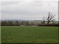
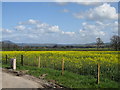
Living in Shropshire means moving to a vast ceremonial county covering 3490.0 square kilometres of England. This large geographical footprint offers significant space compared to many urban centres, allowing for a lifestyle defined by room and distance rather than density. You will find yourself in a rural setting where the sheer scale of the land shapes daily routines and travel patterns. The area is not merely a collection of villages but a substantial region in its own right, situated deep within the Midlands. Its identity is rooted in this expansive terrain, distinguishing it from more compact metropolitan environments. Prospective buyers entering the Shropshire market are purchasing a slice of this large, defined ceremonial county. The size of the area influences how you experience your surroundings, from commute times to access to distant amenities. You are buying into an environment where the physical landscape is as prominent as any social statistic. This magnitude of land defines the character of Shropshire and sets the tone for life there.
- Area Type
- Ceremonial Counties Region
- Area Size
- 3490.0 km²
- Population
- Not available
- Population Density
- Not available
Demographics
The community structure in Shropshire reflects a predominantly older population, with a median age of 70 years. This figure indicates that the majority of residents fall into the senior demographic rather than families with young children or young professionals. You should expect a neighbourhood where established families and retirees form the social backbone, given that the total age population skews significantly towards later life years. Household composition and accommodation types follow naturally from this age profile, as need for space and quiet often differs from younger cohorts. Sixty-six per cent of residents own their homes outright, a high figure that suggests strong financial stability across the older population. This ownership rate of 66% contrasts with many urban areas where renting remains more common. Ethnic diversity and religious affiliation data are not explicitly detailed in the core public statistics for the total region, so the social fabric is best understood through this clear lens of age and ownership. Living in Shropshire means joining a community defined by maturity and long-term settlement.