Area Overview for Ercall Magna
Photos of Ercall Magna
Area Information
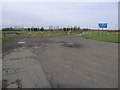
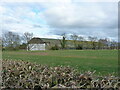
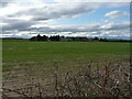
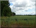
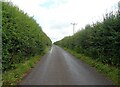
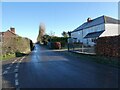
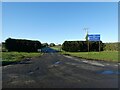
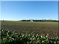
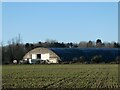
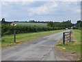
Living in Ercall Magna means residing within a district borough unitary ward that spans 37.4 km² of Cheshire. The area is defined by its quiet character and established residential nature. Prospective buyers will find a setting that caters to those seeking a settled lifestyle rather than rapid urban development. This locality hosts a population where the majority of residents are settled owners, creating a stable community atmosphere. You will find the streets are populated by long-term occupants who understand the pace of life in this specific part of the UK. The layout supports a day-to-day existence centred on local amenities and personal connections rather than high-energy commercial hubs. Your daily routine involves navigating a space where the built environment balances with significant green cover. The ward does not contain Ramsar wetland sites or Areas of Outstanding Natural Beauty, yet it holds protected woodland that contributes to its green infrastructure. This mix of planning constraints and open space shapes your view out of the window. When you consider homes in Ercall Magna, you are choosing a location where the community values protection of natural features over new commercial expansion. The 37.4 km² footprint ensures you are not clogged with density, allowing each household to enjoy a distinct plot. Whether you walk your dog or plan to sit on a patio, the area offers a contained, peaceful environment without the isolation of remote countryside.
- Area Type
- Parish
- Area Size
- 37.4 km²
- Population
- Not available
- Population Density
- Not available
Demographics
The community in Ercall Magna reflects a mature demographic profile dominated by older residents. The median age for the population is 70 years, making it one of the most age-weighted areas in the region. This implies that schools near Ercall Magna may serve a younger population primarily from surrounding towns rather than feeding directly from local birth rates. Your neighbours are likely to be retirees or individuals in retirement age, resulting in a household composition skewed towards single-person homes or couples without children. The prevalence of the 70+ age group means you will often encounter a quieter street life compared to family-centric suburbs. Home ownership stands at 68% within the ward, indicating a very strong preference for purchasing rather than renting. This statistic confirms that most families have moved here to settle permanently rather than viewing the location as a temporary rental base. When you look at accommodation types, the dominance of owner-occupied properties defines the physical character of the street. Diversity in ethnicity and religion data are presented as totals in the available records, allowing you to see the broader make-up of the population. The high ownership figure suggests low churn in the housing stock, meaning your new neighbours will likely live in the same house for decades. You should expect a predictable, stable social environment where change happens slowly. This demographic reality means the local shops and services are tailored to the needs of an older population.
Household Size
Accommodation Type
Tenure
Ethnic Group
Religion
Household Composition
Age
Household Deprivation
NS-SEC
Explore more demographic insights in this area
Go to Demographics tabPlanning
Planning Constraints
- Flood RiskPremium
- Ramsar Wetland SitesPremium
- Area of Outstanding Natural BeautyPremium
- Protected Nature ReservePremium
- Protected WoodlandPremium