Area Overview for HR9 6ND
Photos of HR9 6ND
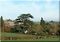
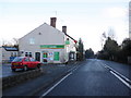
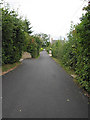
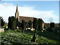
100 photos from this area
Area Information
Key information about the HR9 6ND including its size, population, and administrative classification.
- Area Type
- Postcode
- Area Size
- 6411 m²
- Population
- 1553
- Population Density
- 70 people/km²
House Prices in HR9 6ND
15
Properties
£173,000
Average Sold Price
£54,000
Lowest Price
£290,000
Highest Price
Showing 15 properties
| Address | Type | Beds | Baths | Last Sale Price | Last Sale Date | |
|---|---|---|---|---|---|---|
| 10 Old High Town, Peterstow, HR9 6ND | Cottage | 3 | 1 | £220,000 | Jun 2024 | |
| 6 Old High Town, Peterstow, HR9 6ND | Semi-detached | 3 | 1 | £230,000 | Oct 2022 | |
| 13 Old High Town, Peterstow, HR9 6ND | Terraced | 3 | 1 | £230,000 | Dec 2021 | |
| 5 Old High Town, Peterstow, HR9 6ND | Semi-detached | 3 | 2 | £290,000 | Mar 2021 | |
| 2 Old High Town, Peterstow, HR9 6ND | Terraced | 2 | 1 | £178,000 | May 2020 | |
| 8 Old High Town, Peterstow, HR9 6ND | Terraced | 2 | 1 | £160,000 | Mar 2020 | |
| 4 Old High Town, Peterstow, HR9 6ND | house | - | - | £178,000 | Feb 2017 | |
| 9 Old High Town, Peterstow, HR9 6ND | Terraced | 2 | - | £140,000 | Aug 2016 | |
| 14 Old High Town, Peterstow, HR9 6ND | Terraced | 3 | 1 | £145,000 | Nov 2015 | |
| 3 Old High Town, Peterstow, HR9 6ND | Terraced | 3 | 1 | £158,000 | Aug 2015 |
Page 1 of 2
Energy Efficiency in HR9 6ND
Amenities
Schools
| Rank | School | Type | Entry gender | Ages |
|---|
Explore more schools in this area
Go to Schools tabDemographics
Household Size
Two person
most common
Accommodation Type
Houses
most common
Tenure
78
majority
Ethnic Group
White
most common
Religion
N/A
most common
Household Composition
N/A
most common
Age
47
median
Adults (30-64 years)
most common
Household Deprivation
N/A
with no deprivation
NS-SEC
39
in Lower managerial occupations
Explore more demographic insights in this area
Go to Demographics tabPlanning
Planning Constraints
- Flood RiskPremium
- Ramsar Wetland SitesPremium
- Protected Nature ReservePremium
- Protected WoodlandPremium