Area Overview for HR7 4LP
Photos of HR7 4LP
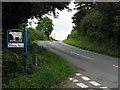
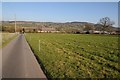
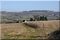
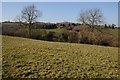

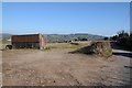
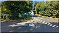
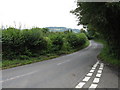
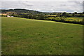
13 photos from this area
Area Information
Key information about the HR7 4LP including its size, population, and administrative classification.
- Area Type
- Postcode
- Area Size
- 1.6 km²
- Population
- 1590
- Population Density
- 133 people/km²
House Prices in HR7 4LP
63
Properties
£479,500
Average Sold Price
£185,000
Lowest Price
£870,000
Highest Price
Showing 63 properties
| Address | Type | Beds | Baths | Last Sale Price | Last Sale Date | |
|---|---|---|---|---|---|---|
| Wheatlands, Wicton Lane, Winslow, HR7 4LP | Bungalow | 4 | 2 | £645,000 | Sep 2020 | |
| Bowmans Hill, Wicton Lane, Winslow, HR7 4LP | Semi-detached | 3 | 1 | £337,000 | Jan 2020 | |
| Winslow Lodge, B 4214 From River Frome To C 1062, Winslow, HR7 4LP | Bungalow | 3 | - | £410,000 | Aug 2017 | |
| Rock Farm, B 4214 From River Frome To C 1062, Winslow, HR7 4LP | Mobile Home | 2 | 2 | £430,000 | Jul 2005 | |
| Hardwicke Manor, Wicton Lane, Winslow, HR7 4LP | Detached | - | - | £870,000 | Nov 2002 | |
| Hainsford, B 4214 From River Frome To C 1062, Winslow, HR7 4LP | house | - | - | £185,000 | Aug 2000 | |
| Meadow View, B 4214 From River Frome To C 1062, Winslow, HR7 4LP | Detached | 3 | 2 | - | - | |
| 13, Rock Farm Caravan Park, B 4214 From Tenbury Road To River Frome, Bromyard, HR7 4LP | Mobile Home | 2 | 2 | - | - | |
| The Old Fold Yard, Hardwicke Manor, Wicton Lane, Winslow, HR7 4LP | house | 4 | 4 | - | - | |
| Pitch 102, Rock Farm Caravan Park, B 4214 From Tenbury Road To River Frome, Bromyard, HR7 4LP | Mobile Home | 3 | 2 | - | - |
Page 1 of 7
Energy Efficiency in HR7 4LP
Amenities
Schools
| Rank | School | Type | Entry gender | Ages |
|---|
Explore more schools in this area
Go to Schools tabDemographics
Household Size
Two person
most common
Accommodation Type
Houses
most common
Tenure
65
majority
Ethnic Group
White
most common
Religion
N/A
most common
Household Composition
N/A
most common
Age
47
median
Adults (30-64 years)
most common
Household Deprivation
N/A
with no deprivation
NS-SEC
23
in Lower managerial occupations
Explore more demographic insights in this area
Go to Demographics tabPlanning
Planning Constraints
- Flood RiskPremium
- Ramsar Wetland SitesPremium
- Area of Outstanding Natural BeautyPremium
- Protected Nature ReservePremium
- Protected WoodlandPremium