Area Overview for HR7 4JZ
Photos of HR7 4JZ
Area Information
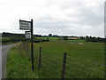
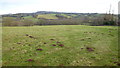
HR7 4JZ is a small residential cluster in England, spanning 26.7 hectares and home to 1405 residents. Its low population density of 117 people per square kilometre suggests a quiet, spread-out community, likely with a mix of single-family homes and small properties. The area’s proximity to Bromyard, a nearby town, may offer access to local services and amenities, though the postcode itself is distinct in its character. With a safety score of 88 out of 100 for crime risk, it is among the safer areas in the region, which is reassuring for families and professionals seeking a stable environment. The absence of flood risk or protected natural sites means residents are unlikely to face environmental constraints, making it a practical choice for those prioritising security and ease of planning. Daily life here appears to revolve around local retail and community spaces, with nearby shops and services within practical reach. The area’s compact size and low density suggest a slower pace of life, ideal for those seeking a balance between seclusion and accessibility.
- Area Type
- Postcode
- Area Size
- 26.7 hectares
- Population
- 1405
- Population Density
- 117 people/km²
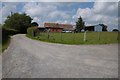
The property market in HR7 4JZ is shaped by its small size and low population density, which likely means a limited number of homes available for sale or rent. While no specific data on home ownership rates or property types is provided, the absence of protected sites or planning constraints may make the area more flexible for development. The compact nature of the postcode suggests that properties here are likely to be single-family homes or small terraced houses, catering to a mix of owner-occupiers and renters. Buyers should consider the area’s proximity to Bromyard for additional services, though the immediate surroundings may offer fewer amenities. The market’s limited scale means that opportunities for purchase could be niche, requiring a targeted search. Those seeking a quiet, low-density environment with minimal planning restrictions may find this area appealing, though the small size could limit options for larger families or those needing more space.
House Prices in HR7 4JZ
Showing 6 properties
| Address | Type | Beds | Baths | Last Sale Price | Last Sale Date | |
|---|---|---|---|---|---|---|
| Copper Beech, Church Road, Avenbury, HR7 4JZ | Bungalow | - | - | £350,000 | Mar 2022 | |
| 2, Hawthorne Cottages, Church Road, Avenbury, HR7 4JZ | Cottage | 3 | 1 | £222,000 | Nov 2017 | |
| 1A, Hawthorne Cottages, Church Road, Avenbury, HR7 4JZ | house | - | - | £73,000 | Nov 2000 | |
| Hunters Lodge, Church Road, Avenbury, HR7 4JZ | Bungalow | - | - | £120,000 | Sep 2000 | |
| Hawthorns, Church Road, Avenbury, HR7 4JZ | Detached | - | - | - | - | |
| Holly Hill, Church Road, Avenbury, HR7 4JZ | house | - | - | - | - |
Energy Efficiency in HR7 4JZ
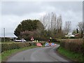
Living in HR7 4JZ offers access to nearby retail options, including Morrisons Daily Bromyard and two Co-op stores in Bromyard. These shops provide essential groceries and daily necessities, reducing the need for long trips to larger towns. While the area itself does not list parks or leisure facilities, its proximity to Bromyard may offer recreational opportunities, such as local walks or community centres. The retail presence suggests a functional, practical lifestyle, with convenience for shopping and routine errands. The area’s small scale means that daily life is likely centred around local amenities, with a focus on simplicity and accessibility. For those who prefer a self-contained environment, HR7 4JZ’s shops and services provide a baseline for comfort, though residents may need to travel further for more specialised amenities.
Amenities
Schools
| Rank | School | Type | Entry gender | Ages |
|---|
Explore more schools in this area
Go to Schools tabDemographics
The population of HR7 4JZ totals 1405, spread across 26.7 hectares, resulting in a density of 117 people per square kilometre. This figure indicates a sparse, low-rise residential layout, typical of smaller rural or semi-rural clusters. While no specific data on age distribution or household composition is provided, the area’s small size and low density suggest a mix of family homes and possibly some retirement properties. The absence of deprivation metrics in the data means it is not possible to assess the area’s socioeconomic challenges or opportunities. However, the low crime risk score of 88 implies a relatively stable community, which may support a higher quality of life for residents. The lack of protected natural areas or planning constraints further suggests that the area is free from restrictions that could impact housing development or land use.
Household Size
Accommodation Type
Tenure
Ethnic Group
Religion
Household Composition
Age
Household Deprivation
NS-SEC
Explore more demographic insights in this area
Go to Demographics tabPlanning
Planning Constraints
- Flood RiskPremium
- Ramsar Wetland SitesPremium
- Area of Outstanding Natural BeautyPremium
- Protected Nature ReservePremium