Area Overview for HR7 4JX
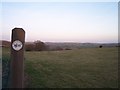
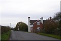
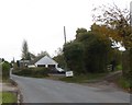
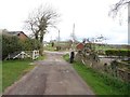
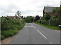
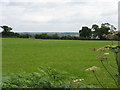
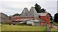
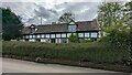
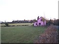
Photos of HR7 4JX
Area Information
Living in HR7 4JX offers a quiet, low-density lifestyle in a small residential cluster spanning 89.7 hectares. With a population of 1,405, the area is characterised by a mature demographic, reflecting its median age of 47 and a significant proportion of elderly residents. This makes HR7 4JX a place where community ties are likely strong, with a focus on stability and long-term living. The area’s compact size means it is easy to navigate on foot or by bicycle, with no major roads or motorways nearby. Its low flood risk and below-average crime rates contribute to a sense of security, while the absence of protected natural sites like AONBs or Ramsar wetlands means development constraints are minimal. For those seeking a peaceful, settled environment with minimal environmental risk, HR7 4JX provides a straightforward, uncomplicated living experience. The area’s small scale also means it is unlikely to be affected by large-scale urbanisation, preserving its character for residents.
- Area Type
- Postcode
- Area Size
- 89.7 hectares
- Population
- 1405
- Population Density
- 117 people/km²
The property market in HR7 4JX is dominated by owner-occupied homes, with 85% of properties being owned by residents rather than rented. The area’s accommodation type is primarily houses, which is unusual for a small postcode area and suggests a focus on family-sized or single-dwelling properties. This contrasts with areas where flats or apartments predominate, and it may indicate that HR7 4JX is not a hotspot for rental investment. The limited size of the area—89.7 hectares—means the housing stock is finite, which could lead to competition among buyers. For those seeking a home in this area, the emphasis on houses and high home ownership implies a market where properties are likely to remain in private hands for extended periods. This could be advantageous for buyers looking for long-term stability but may limit availability for those entering the market.
House Prices in HR7 4JX
Showing 20 properties
| Address | Type | Beds | Baths | Last Sale Price | Last Sale Date | |
|---|---|---|---|---|---|---|
| Stone Cottage, B 4214 From Gorsty Lane To Cusop Farm, Munderfield, HR7 4JX | house | 4 | 2 | £472,500 | Sep 2025 | |
| Tanglewood, B 4214 From Gorsty Lane To Cusop Farm, Munderfield, HR7 4JX | house | - | - | £390,000 | Jul 2020 | |
| Cusop Cottage, B 4214 From Gorsty Lane To Cusop Farm, Munderfield, HR7 4JX | Semi-detached | - | - | £237,600 | Apr 2019 | |
| The Cider House, B 4214 From Gorsty Lane To Cusop Farm, Munderfield, HR7 4JX | Detached | 5 | 1 | £355,000 | Oct 2001 | |
| Long Cottage, B 4214 From Gorsty Lane To Cusop Farm, Munderfield, HR7 4JX | Detached | - | - | £122,500 | Oct 1999 | |
| Chapel House, B 4214 From Gorsty Lane To Cusop Farm, Munderfield, HR7 4JX | house | 3 | 1 | £85,000 | Jun 1998 | |
| Avenholme, B 4214 From Gorsty Lane To Cusop Farm, Munderfield, HR7 4JX | Bungalow | 4 | - | - | - | |
| Mobile Home At The Secret Garden, B 4214 From Gorsty Lane To Cusop Farm, Munderfield, HR7 4JX | Mobile Home | - | - | - | - | |
| The Orchard, B 4214 From Gorsty Lane To Cusop Farm, Munderfield, HR7 4JX | house | - | - | - | - | |
| Woodland View, B 4214 From Gorsty Lane To Cusop Farm, Munderfield, HR7 4JX | Bungalow | - | - | - | - |
Energy Efficiency in HR7 4JX
Residents of HR7 4JX have access to essential retail amenities within practical reach, including Morrisons Daily Bromyard and two branches of Co-op Bromyard. These stores provide everyday shopping needs, from groceries to household items, reducing the need for long trips to larger centres. While the area lacks major parks or leisure facilities, the proximity to retail hubs suggests a focus on convenience over recreation. The absence of named parks or cultural venues in the data means outdoor activities may require travel to nearby towns. However, the area’s low population density and small size may contribute to a quieter, more relaxed lifestyle. For those prioritising ease of shopping and a low-stress environment, HR7 4JX offers a straightforward, functional setup that supports daily living without the need for extensive travel.
Amenities
Schools
| Rank | School | Type | Entry gender | Ages |
|---|
Explore more schools in this area
Go to Schools tabDemographics
The community in HR7 4JX is predominantly elderly, with 65+ years being the most common age range. This is reflected in the area’s median age of 47, which is higher than the national average, suggesting a population that values stability and established living. Home ownership is exceptionally high at 85%, indicating that most residents are long-term residents rather than renters. The accommodation is largely composed of houses, which aligns with the area’s low density and suburban feel. The predominant ethnic group is White, which shapes the cultural and social dynamics of the neighbourhood. While no specific data on deprivation or diversity is provided, the high home ownership rate and mature demographic suggest a community with relatively consistent economic conditions. This profile may appeal to those seeking a retirement-friendly environment with minimal change over time.
Household Size
Accommodation Type
Tenure
Ethnic Group
Religion
Household Composition
Age
Household Deprivation
NS-SEC
Explore more demographic insights in this area
Go to Demographics tabPlanning
Planning Constraints
- Flood RiskPremium
- Ramsar Wetland SitesPremium
- Area of Outstanding Natural BeautyPremium
- Protected Nature ReservePremium
- Protected WoodlandPremium