Area Overview for HR7 4HQ
Photos of HR7 4HQ
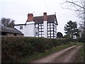
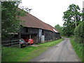
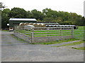
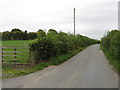
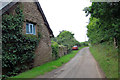
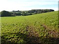
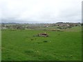
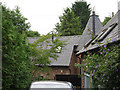
Area Information
HR7 4HQ is a small, residential postcode area in England, covering just 1.0 km² with a population of 1,437 people. The low population density of 29 people per square kilometre suggests a quiet, community-focused environment, where homes are spaced apart and private gardens may be common. This area is likely to appeal to those seeking a slower pace of life, with a stable demographic profile dominated by adults aged 30–64. The presence of two primary schools nearby, including Pencombe CofE Primary School with a good Ofsted rating, indicates a family-oriented character. Residents benefit from good broadband connectivity and low crime rates, making it a safe place to live. While the area is small, it is served by local amenities such as Co-op and Morrisons stores, ensuring daily essentials are within reach. The low flood risk and absence of environmental constraints like protected woodlands or AONB designations further enhance its appeal as a practical, low-maintenance location for homeowners.
- Area Type
- Postcode
- Area Size
- 1.0 km²
- Population
- 1437
- Population Density
- 29 people/km²
HR7 4HQ is a predominantly owner-occupied area, with 76% of homes owned by residents rather than rented. The accommodation type is primarily houses, which may reflect the area’s low population density and potential for larger properties. Given the small size of the postcode area—just 1.0 km²—this suggests a limited number of properties, potentially making the housing stock more exclusive or tightly held. The focus on owner-occupied homes indicates a community of long-term residents, which could influence property values and market dynamics. For buyers, this means competition may be limited, but the small size of the area could also mean that opportunities are confined to a narrow geographic radius. The absence of rental properties in the data implies that the market is not driven by short-term lets or student housing, further reinforcing its appeal to families and retirees seeking stability.
House Prices in HR7 4HQ
Showing 14 properties
| Address | Type | Beds | Baths | Last Sale Price | Last Sale Date | |
|---|---|---|---|---|---|---|
| The Ryelands, Wood End Lane, Stoke Lacy, HR7 4HQ | Retail | 4 | 3 | £510,000 | Feb 2024 | |
| The Ditchings, Wood End Lane, Stoke Lacy, HR7 4HQ | house | - | - | £435,000 | May 2022 | |
| Caris Croft, Wood End Lane, Stoke Lacy, HR7 4HQ | house | - | - | £475,000 | Mar 2021 | |
| Lower Woodend, Wood End Lane, Stoke Lacy, HR7 4HQ | Detached | 3 | - | £550,000 | Feb 2017 | |
| Hales Bank, Wood End Lane, Stoke Lacy, HR7 4HQ | house | - | - | £295,000 | Jul 2015 | |
| Hillcrest, Wood End Lane, Stoke Lacy, HR7 4HQ | house | - | - | £625,000 | Jan 2007 | |
| Woodend Cottage, Wood End Lane, Stoke Lacy, HR7 4HQ | Detached | - | - | £415,000 | Jan 2006 | |
| The Folly, Wood End Lane, Stoke Lacy, HR7 4HQ | Detached | - | - | £170,000 | Sep 1998 | |
| The Hop Kiln, Wood End Lane, Stoke Lacy, HR7 4HQ | house | 3 | - | - | - | |
| The Ryelands, Wood End Lane, Stoke Lacy, HR7 4HQ | undefined | - | - | - | - |
Energy Efficiency in HR7 4HQ
The lifestyle in HR7 4HQ is shaped by its proximity to local amenities, including four retail outlets such as Morrisons Daily Bromyard and Co-op Bromyard. These stores provide access to groceries, household goods, and other essentials, reducing the need for long trips to larger towns. The area’s small size means that these amenities are likely within walking or short driving distance, contributing to a convenient daily life. While the data does not mention parks, leisure facilities, or dining options, the presence of schools and retail suggests a focus on practicality over luxury. The low population density may mean that public spaces are limited, but the absence of environmental constraints like protected woodlands or AONB designations could allow for more local development. Overall, the lifestyle here appears to prioritise accessibility and stability over expansive leisure opportunities.
Amenities
Schools
Residents of HR7 4HQ have access to two primary schools: Burley Gate CofE Primary School and Pencombe CofE Primary School. Both are state-funded and likely serve the local community, though Pencombe CofE Primary School holds a good Ofsted rating, which may be a key consideration for families. The duplication of Burley Gate CofE Primary School in the data may indicate a nearby campus or a secondary school, but the data does not clarify this. The presence of two primary schools within practical reach suggests that parents have options, though the area’s small size may mean that these schools are the primary educational institutions available. For families prioritising school quality, Pencombe’s good rating could be a deciding factor. However, the lack of secondary schools or further education facilities in the data means that residents may need to travel for higher education.
| Rank | School | Type | Entry gender | Ages |
|---|
Explore more schools in this area
Go to Schools tabDemographics
The population of HR7 4HQ is predominantly adults, with a median age of 47 and 76% of residents owning their homes. This suggests a mature, settled community with a strong emphasis on home ownership. The accommodation type is primarily houses, which aligns with the area’s low density and likely suburban or rural setting. The predominant ethnic group is White, though no data is provided on other demographics. With 29 people per square kilometre, the area is not densely populated, offering more space per household than many urban centres. This density level may contribute to a quieter, less congested environment. The age profile, skewed towards middle-aged adults, implies a community with fewer children relative to other areas, though the presence of two primary schools suggests some families reside here. The high home ownership rate indicates stability, with residents likely to have long-term ties to the area.
Household Size
Accommodation Type
Tenure
Ethnic Group
Religion
Household Composition
Age
Household Deprivation
NS-SEC
Explore more demographic insights in this area
Go to Demographics tabPlanning
Planning Constraints
- Flood RiskPremium
- Ramsar Wetland SitesPremium
- Area of Outstanding Natural BeautyPremium
- Protected Nature ReservePremium
- Protected WoodlandPremium