Area Overview for HR7 4HH
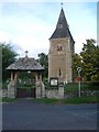
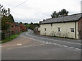
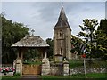
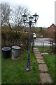
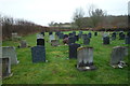
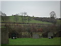
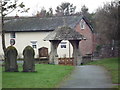
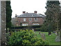
Photos of HR7 4HH


Area Information
Living in HR7 4HH means being part of a small, tightly knit residential cluster in England. The area spans 35.9 hectares, with a population of 1437 people spread across 29 residents per square kilometre. This low density suggests a quiet, suburban feel, where homes are spaced apart, and community interactions are likely to be personal. The area’s demographic profile shows a mature population, with a median age of 47 and the majority of residents aged 30–64. This suggests a stable, established community, with many households owning their homes—76% of properties are owner-occupied. Daily life here is likely to revolve around local amenities, schools, and the surrounding countryside. The absence of major planning constraints, such as protected woodlands or AONB designations, means development pressures are minimal. For those seeking a peaceful, low-maintenance lifestyle with access to essential services, HR7 4HH offers a straightforward, uncluttered living environment.
- Area Type
- Postcode
- Area Size
- 35.9 hectares
- Population
- 1437
- Population Density
- 29 people/km²
The property market in HR7 4HH is characterised by a high rate of home ownership—76% of residents own their homes. This suggests a strong owner-occupied market, with limited rental activity. The accommodation type is exclusively houses, not flats or apartments, which is typical of smaller, low-density areas. Given the area’s small size (35.9 hectares) and modest population, the housing stock is likely limited to a few dozen properties. Buyers should consider that the market is not large, so availability may be constrained. The absence of planning constraints such as protected woodlands or AONB designations may make the area more attractive for those seeking a quiet, low-maintenance home. However, the small scale means that property values and availability could be influenced heavily by local factors rather than broader regional trends.
House Prices in HR7 4HH
Showing 8 properties
| Address | Type | Beds | Baths | Last Sale Price | Last Sale Date | |
|---|---|---|---|---|---|---|
| The Old Coach House, A 465 From Panniers Lane To Cowarne Cottage, Stoke Lacy, HR7 4HH | Semi-detached | 4 | 3 | £570,000 | Dec 2024 | |
| The Morgans, A 465 From Panniers Lane To Cowarne Cottage, Stoke Lacy, HR7 4HH | Character Property | 2 | 2 | £351,000 | Jan 2022 | |
| The Courtyard, A 465 From Panniers Lane To Cowarne Cottage, Stoke Lacy, HR7 4HH | Maisonette | - | - | £470,000 | Oct 2014 | |
| The Old Rectory, A 465 From Panniers Lane To Cowarne Cottage, Stoke Lacy, HR7 4HH | Semi-detached | 5 | 2 | - | - | |
| Green Mantle, A 465 From Panniers Lane To Cowarne Cottage, Stoke Lacy, HR7 4HH | Detached | - | - | - | - | |
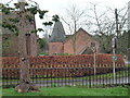
| Church House, A 465 From Panniers Lane To Cowarne Cottage, Stoke Lacy, HR7 4HH | Detached | - | - | - | - | |
| The Annexe At The Old Coach House, The Old Coach House, A 465 From Panniers Lane To Cowarne Cottage, Stoke Lacy, HR7 4HH | Semi-detached | - | - | - | - | |
| Ty Bach, A 465 From Panniers Lane To Cowarne Cottage, Stoke Lacy, HR7 4HH | Detached | - | - | - | - |
Energy Efficiency in HR7 4HH
The nearest amenities to HR7 4HH include four retail outlets: Spar, Morrisons Daily Bromyard, and Co-op Bromyard. These shops provide access to groceries, daily essentials, and other retail services, supporting a basic level of convenience for residents. While no specific details about dining, parks, or leisure facilities are included in the data, the presence of multiple retail options suggests that everyday needs can be met locally. The area’s low population density may mean that larger leisure or entertainment venues are located further afield. Nonetheless, the availability of nearby shops contributes to a practical, self-sufficient lifestyle, reducing the need for long commutes to larger towns or cities.
Amenities
Schools
Residents of HR7 4HH have access to two primary schools: Burley Gate CofE Primary School and Pencombe CofE Primary School. Pencombe CofE Primary School holds an Ofsted rating of “good,” indicating a solid standard of education. Both schools serve the local community, providing primary-level education for children in the area. The presence of two primary schools within reach suggests that families have options for their children’s early education, though no secondary schools are listed in the data. The mix of schools—both being primary—means that parents may need to look further afield for secondary education. However, the “good” rating at Pencombe offers reassurance for families prioritising quality schooling in the immediate vicinity.
| Rank | School | Type | Entry gender | Ages |
|---|
Explore more schools in this area
Go to Schools tabDemographics
The community in HR7 4HH is predominantly composed of adults aged 30–64, with a median age of 47. This indicates a mature population, likely with established careers and families. Home ownership is high, with 76% of residents living in properties they own, suggesting a stable housing market. The accommodation type is primarily houses, not flats, which aligns with the area’s low population density. The predominant ethnic group is White, though no specific data on diversity or deprivation is provided. The low population density of 29 people per square kilometre implies a spread-out, perhaps rural or semi-rural setting, where residents may value privacy and space over urban density. This demographic profile suggests a community focused on long-term residency, with fewer transient residents.
Household Size
Accommodation Type
Tenure
Ethnic Group
Religion
Household Composition
Age
Household Deprivation
NS-SEC
Explore more demographic insights in this area
Go to Demographics tabPlanning
Planning Constraints
- Flood RiskPremium
- Ramsar Wetland SitesPremium
- Area of Outstanding Natural BeautyPremium
- Protected Nature ReservePremium
- Protected WoodlandPremium