Area Overview for HR6 0EZ
Photos of HR6 0EZ
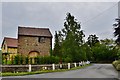
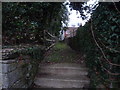
![Yarpole Methodist Church [Wesleyan Chapel] in HR6 0EZ](https://images.propbar.co.uk/images/geograph/60/13/6013087_120.jpg)
35 photos from this area
Area Information
Key information about the HR6 0EZ including its size, population, and administrative classification.
- Area Type
- Postcode
- Area Size
- 19.8 hectares
- Population
- 1417
- Population Density
- 52 people/km²
House Prices in HR6 0EZ
7
Properties
£620,714
Average Sold Price
£565,000
Lowest Price
£685,000
Highest Price
Showing 7 properties
| Address | Type | Beds | Baths | Last Sale Price | Last Sale Date | |
|---|---|---|---|---|---|---|
| Bluebell Cottage, 2 Mulberry Meadow, Yarpole, HR6 0EZ | house | 3 | 2 | £565,000 | Feb 2025 | |
| Primrose Cottage, 1 Mulberry Meadow, Yarpole, HR6 0EZ | house | 3 | 2 | £575,000 | Aug 2024 | |
| Foxglove House, 6 Mulberry Meadow, Yarpole, HR6 0EZ | house | - | - | £685,000 | Jul 2023 | |
| Cornflower Cottage, 3 Mulberry Meadow, Yarpole, HR6 0EZ | house | - | - | £575,000 | Sep 2022 | |
| Hollyhock House, 5 Mulberry Meadow, Yarpole, HR6 0EZ | house | - | - | £675,000 | Sep 2022 | |
| Honeysuckle House, 7 Mulberry Meadow, Yarpole, HR6 0EZ | house | - | - | £625,000 | Sep 2022 | |
| Lilac Cottage, 4 Mulberry Meadow, Yarpole, HR6 0EZ | Detached | 4 | 2 | £645,000 | Sep 2022 |
Energy Efficiency in HR6 0EZ
Amenities
Schools
| Rank | School | Type | Entry gender | Ages |
|---|
Explore more schools in this area
Go to Schools tabDemographics
Household Size
Two person
most common
Accommodation Type
Houses
most common
Tenure
84
majority
Ethnic Group
White
most common
Religion
N/A
most common
Household Composition
N/A
most common
Age
47
median
Adults (30-64 years)
most common
Household Deprivation
N/A
with no deprivation
NS-SEC
39
in Lower managerial occupations
Explore more demographic insights in this area
Go to Demographics tabPlanning
Planning Constraints
- Flood RiskPremium
- Ramsar Wetland SitesPremium
- Area of Outstanding Natural BeautyPremium
- Protected Nature ReservePremium
- Protected WoodlandPremium