Area Overview for HR5 3RE
Photos of HR5 3RE

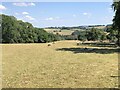
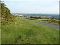
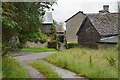
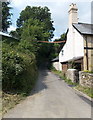
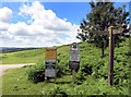
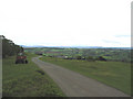
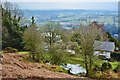
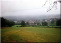
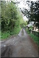
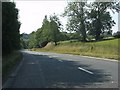
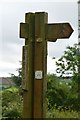
13 photos from this area
Area Information
Key information about the HR5 3RE including its size, population, and administrative classification.
- Area Type
- Postcode
- Area Size
- 1.5 km²
- Population
- 1768
- Population Density
- 50 people/km²
House Prices in HR5 3RE
29
Properties
£346,500
Average Sold Price
£120,000
Lowest Price
£637,000
Highest Price
Showing 29 properties
| Address | Type | Beds | Baths | Last Sale Price | Last Sale Date | |
|---|---|---|---|---|---|---|
| Bradnor House, Barton Lane, Bradnor, HR5 3RE | Detached | 4 | 3 | £637,000 | Mar 2025 | |
| The Beacon, Barton Lane, Bradnor, HR5 3RE | Detached | 4 | 4 | £500,000 | Dec 2021 | |
| Bradnor Cottage, Barton Lane, Bradnor, HR5 3RE | Detached | 3 | 1 | £300,000 | Oct 2019 | |
| Rackway Farm, Barton Lane, Bradnor, HR5 3RE | Detached | - | - | £350,000 | Aug 2018 | |
| Ridge View Cottage, Barton Lane, Bradnor, HR5 3RE | Detached | 2 | 1 | £310,000 | Dec 2017 | |
| Shepherds Close, Barton Lane, Bradnor, HR5 3RE | Detached | - | - | £315,000 | Jan 2014 | |
| Hill House, Barton Lane, Bradnor, HR5 3RE | Detached | - | - | £240,000 | Sep 2006 | |
| Rose Cottage, Barton Lane, Bradnor, HR5 3RE | house | - | - | £120,000 | Mar 1995 | |
| Oak Tree House, Barton Lane, Bradnor, HR5 3RE | Detached | 3 | - | - | - | |
| Annexe, The Beacon, Barton Lane, Bradnor, HR5 3RE | Semi-detached | - | - | - | - |
Page 1 of 3
Energy Efficiency in HR5 3RE
Amenities
Schools
| Rank | School | Type | Entry gender | Ages |
|---|
Explore more schools in this area
Go to Schools tabDemographics
Household Size
Two person
most common
Accommodation Type
Houses
most common
Tenure
65
majority
Ethnic Group
White
most common
Religion
N/A
most common
Household Composition
N/A
most common
Age
47
median
Adults (30-64 years)
most common
Household Deprivation
N/A
with no deprivation
NS-SEC
28
in Lower managerial occupations
Explore more demographic insights in this area
Go to Demographics tabPlanning
Planning Constraints
- Flood RiskPremium
- Ramsar Wetland SitesPremium
- Area of Outstanding Natural BeautyPremium
- Protected Nature ReservePremium
- Protected WoodlandPremium