Area Overview for HR5 3NG
Photos of HR5 3NG

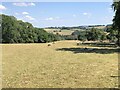
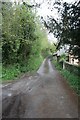
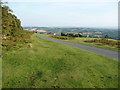
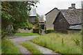
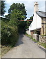
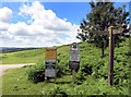
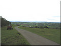

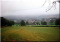

13 photos from this area
Area Information
Key information about the HR5 3NG including its size, population, and administrative classification.
- Area Type
- Postcode
- Area Size
- 9.2 hectares
- Population
- 1768
- Population Density
- 50 people/km²
House Prices in HR5 3NG
6
Properties
£201,125
Average Sold Price
£49,500
Lowest Price
£290,000
Highest Price
Showing 6 properties
| Address | Type | Beds | Baths | Last Sale Price | Last Sale Date | |
|---|---|---|---|---|---|---|
| 3, Newton Row, Newton Lane From A 44 To Rhueville Farm Track, Floodgates, HR5 3NG | Cottage | 2 | 1 | £255,000 | Oct 2017 | |
| Hollybush Cottage, Newton Lane, Floodgates, HR5 3NG | house | 3 | - | £290,000 | Sep 2015 | |
| 1, Mole Bank Cottage, Newton Row, Newton Lane, Floodgates, HR5 3NG | Detached | - | - | £210,000 | May 2008 | |
| 2, Porthlad Clydd, Newton Row, Newton Lane, Floodgates, HR5 3NG | Detached | 3 | - | £49,500 | Mar 1998 | |
| Dancing Down, Newton Bank, Floodgates, HR5 3NG | house | - | - | - | - | |
| Newton House, Newton Lane, Floodgates, HR5 3NG | Detached | - | - | - | - |
Energy Efficiency in HR5 3NG
Amenities
Schools
| Rank | School | Type | Entry gender | Ages |
|---|
Explore more schools in this area
Go to Schools tabDemographics
Household Size
Two person
most common
Accommodation Type
Houses
most common
Tenure
65
majority
Ethnic Group
White
most common
Religion
N/A
most common
Household Composition
N/A
most common
Age
47
median
Adults (30-64 years)
most common
Household Deprivation
N/A
with no deprivation
NS-SEC
28
in Lower managerial occupations
Explore more demographic insights in this area
Go to Demographics tabPlanning
Planning Constraints
- Flood RiskPremium
- Ramsar Wetland SitesPremium
- Area of Outstanding Natural BeautyPremium
- Protected Nature ReservePremium
- Protected WoodlandPremium