Area Overview for HR2 9BS
Photos of HR2 9BS
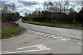
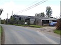
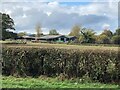
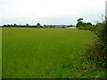

6 photos from this area
Area Information
Key information about the HR2 9BS including its size, population, and administrative classification.
- Area Type
- Postcode
- Area Size
- 40.9 hectares
- Population
- 1827
- Population Density
- 33 people/km²
House Prices in HR2 9BS
19
Properties
£321,351
Average Sold Price
£165,000
Lowest Price
£515,000
Highest Price
Showing 19 properties
| Address | Type | Beds | Baths | Last Sale Price | Last Sale Date | |
|---|---|---|---|---|---|---|
| Silverdale, Winnal Common Road From B 438 To Springfield, Winnal, HR2 9BS | Bungalow | - | - | £315,000 | Dec 2021 | |
| Springfield, Winnal Common Road From B 438 To Springfield, Winnal, HR2 9BS | Land | - | - | £515,000 | Mar 2020 | |
| Balaclava, Winnal Common Road From B 438 To Springfield, Winnal, HR2 9BS | Bungalow | - | - | £254,113 | Nov 2018 | |
| Poplar Clays, Winnal Common Road From B 438 To Springfield, Winnal, HR2 9BS | house | - | - | £399,000 | Aug 2018 | |
| Willerby Cottage, Winnal Common Road From B 438 To Springfield, Winnal, HR2 9BS | house | - | - | £279,995 | Aug 2003 | |
| Colaba Lodge, Winnal Common Road From B 438 To Springfield, Winnal, HR2 9BS | Detached | - | - | £165,000 | Nov 2002 | |
| Annexe, Linden, Winnal Common Road From B 438 To Springfield, Winnal, HR2 9BS | Farm | - | - | - | - | |
| Winnal House, Winnal Common Road From B 438 To Springfield, Winnal, HR2 9BS | Detached | 4 | - | - | - | |
| Winnal Common Farm, Winnal Common Road From B 438 To Springfield, Winnal, HR2 9BS | Detached | - | - | - | - | |
| Yew Tree Cottage, Winnal Common Road From B 438 To Springfield, Winnal, HR2 9BS | Detached | - | - | - | - |
Page 1 of 2
Energy Efficiency in HR2 9BS
Amenities
Schools
| Rank | School | Type | Entry gender | Ages |
|---|
Explore more schools in this area
Go to Schools tabDemographics
Household Size
Two person
most common
Accommodation Type
Houses
most common
Tenure
75
majority
Ethnic Group
White
most common
Religion
N/A
most common
Household Composition
N/A
most common
Age
47
median
Adults (30-64 years)
most common
Household Deprivation
N/A
with no deprivation
NS-SEC
33
in Lower managerial occupations
Explore more demographic insights in this area
Go to Demographics tabPlanning
Planning Constraints
- Flood RiskPremium
- Ramsar Wetland SitesPremium
- Area of Outstanding Natural BeautyPremium
- Protected Nature ReservePremium
- Protected WoodlandPremium