Area Overview for HR2 9AW
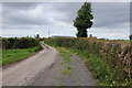
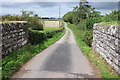
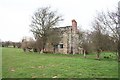
Photos of HR2 9AW


Area Information
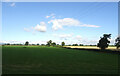
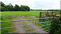
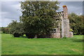
Living in HR2 9AW means inhabiting a small, low-density residential area in England’s Herefordshire region. Covering just 1.1 km², this postcode cluster is home to 1,827 residents, spread across a landscape that balances quiet living with practical amenities. The area’s character is defined by its modest scale and the presence of local services that cater to daily needs. With a population density of 33 people per square kilometre, it offers a relaxed, community-focused environment. Nearby, the Hereford Railway Station provides access to regional transport, while independent and state schools serve families. The area’s appeal lies in its simplicity: a place where homes are predominantly owner-occupied, and the pace of life is unhurried. For those seeking a balance between seclusion and accessibility, HR2 9AW combines the benefits of a small community with the convenience of nearby retail and transport links. Its compact size means residents can easily access essential services without venturing far, making it ideal for those prioritising a low-maintenance lifestyle.
- Area Type
- Postcode
- Area Size
- 1.1 km²
- Population
- 1827
- Population Density
- 33 people/km²
The property market in HR2 9AW is characterised by a high rate of home ownership—75% of residents own their homes. This suggests a stable, long-term market with limited turnover, as opposed to areas dominated by rental properties. The accommodation type is predominantly houses, which is typical of low-density, suburban areas. This housing stock implies that the area is less likely to cater to younger professionals or students seeking flats, and more suited to families or individuals preferring larger, private living spaces. Given the small size of the postcode area, the housing options are likely limited to a handful of properties, making it a niche market for buyers seeking a specific type of property. The high ownership rate also means that the area may have fewer vacant properties, reducing competition for buyers. For those considering this area, the focus should be on established homes rather than speculative investment, as the market is likely to prioritise stability over rapid growth.
House Prices in HR2 9AW
No properties found in this postcode.
Energy Efficiency in HR2 9AW
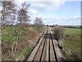
The lifestyle in HR2 9AW is shaped by its proximity to essential amenities within a short distance. Nearby, the Tesco Hereford, Morrisons Daily, and Farmfoods Newton provide a range of retail options, from everyday groceries to fresh produce. These stores cater to both routine shopping and convenience, reducing the need for long trips to larger centres. The Hereford Railway Station adds to the area’s accessibility, allowing residents to travel further afield with ease. While the area itself is small, its amenities are sufficient for daily needs, fostering a self-contained yet connected community. The presence of these services ensures that residents can manage household tasks efficiently, whether they are cooking meals at home or running errands. The character of the area is defined by its practicality—everyday life is streamlined without sacrificing the comfort of a quiet, low-density environment.
Amenities
Schools
Residents of HR2 9AW have access to two notable schools within practical reach. Hereford Waldorf School is an independent institution, offering an alternative educational approach. The Steiner Academy Hereford, an academy with a good Ofsted rating, provides state-funded education with a focus on holistic development. This mix of independent and state schools offers families flexibility in choosing educational pathways. The presence of a high-rated academy suggests a commitment to quality education, which is a key consideration for families. Both institutions are likely to attract residents seeking a structured yet diverse learning environment for their children. The proximity of these schools to the area reinforces its appeal as a family-friendly location, where educational options are accessible without requiring long commutes.
| Rank | School | Type | Entry gender | Ages |
|---|
Explore more schools in this area
Go to Schools tabDemographics
The community in HR2 9AW is predominantly composed of adults aged 30–64, with a median age of 47. This suggests a mature, established population, many of whom are likely to be long-term residents. Home ownership is high, at 75%, indicating a stable, owner-occupied market rather than a rental-driven area. The accommodation type is primarily houses, which aligns with the area’s low density and suburban character. The predominant ethnic group is White, reflecting a homogenous demographic profile. With a population of 1,827 spread over 1.1 km², the area maintains a low population density of 33 people per square kilometre, contributing to a sense of space and privacy. This profile suggests a community focused on family living and long-term residency, with fewer transient populations. The absence of specific data on deprivation or diversity means the area’s social dynamics are likely to be consistent with its demographic composition, prioritising stability over rapid change.
Household Size
Accommodation Type
Tenure
Ethnic Group
Religion
Household Composition
Age
Household Deprivation
NS-SEC
Explore more demographic insights in this area
Go to Demographics tabPlanning
Planning Constraints
- Flood RiskPremium
- Ramsar Wetland SitesPremium
- Area of Outstanding Natural BeautyPremium
- Protected Nature ReservePremium
- Protected WoodlandPremium