Area Overview for HR2 8DD
Photos of HR2 8DD
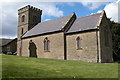
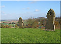
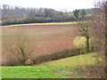
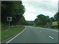
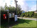
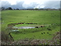
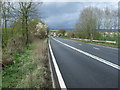

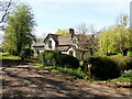
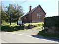

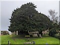
26 photos from this area
Area Information
Key information about the HR2 8DD including its size, population, and administrative classification.
- Area Type
- Postcode
- Area Size
- 37.2 hectares
- Population
- 2050
- Population Density
- 39 people/km²
House Prices in HR2 8DD
11
Properties
£348,333
Average Sold Price
£300,000
Lowest Price
£440,000
Highest Price
Showing 11 properties
| Address | Type | Beds | Baths | Last Sale Price | Last Sale Date | |
|---|---|---|---|---|---|---|
| School House, C 1226 From A 49 To Hillcrest, Callow, HR2 8DD | house | 4 | 1 | £300,000 | Jul 2024 | |
| Timber Top, C 1226 From A 49 To Hillcrest, Callow, HR2 8DD | Bungalow | - | - | £440,000 | Feb 2022 | |
| The Patch, C 1226 From A 49 To Hillcrest, Callow, HR2 8DD | Detached | - | - | £305,000 | Nov 2004 | |
| The Copse, C 1226 From A 49 To Hillcrest, Callow, HR2 8DD | Detached | 4 | 3 | - | - | |
| Church Cottage, C 1226 From A 49 To Hillcrest, Callow, HR2 8DD | Detached | - | - | - | - | |
| Coldnose Farm, C 1226 From A 49 To Hillcrest, Callow, HR2 8DD | Detached | - | - | - | - | |
| Dewsall Lodge, C 1226 From A 49 To Hillcrest, Callow, HR2 8DD | house | - | - | - | - | |
| Copper Beeches, C 1226 From A 49 To Hillcrest, Callow, HR2 8DD | house | - | - | - | - | |
| Foxes Bark, C 1226 From A 49 To Hillcrest, Callow, HR2 8DD | Bungalow | 1 | 1 | - | - | |
| Quarry Bank, Dewsall Road, Callow, HR2 8DD | house | - | - | - | - |
Page 1 of 2
Energy Efficiency in HR2 8DD
Amenities
Schools
| Rank | School | Type | Entry gender | Ages |
|---|
Explore more schools in this area
Go to Schools tabDemographics
Household Size
Two person
most common
Accommodation Type
Houses
most common
Tenure
78
majority
Ethnic Group
White
most common
Religion
N/A
most common
Household Composition
N/A
most common
Age
47
median
Adults (30-64 years)
most common
Household Deprivation
N/A
with no deprivation
NS-SEC
38
in Lower managerial occupations
Explore more demographic insights in this area
Go to Demographics tabPlanning
Planning Constraints
- Flood RiskPremium
- Ramsar Wetland SitesPremium
- Area of Outstanding Natural BeautyPremium
- Protected Nature ReservePremium
- Protected WoodlandPremium