Area Overview for HR2 8BP
Photos of HR2 8BP
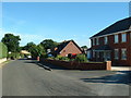

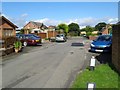

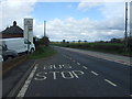
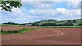
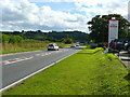
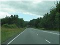
27 photos from this area
Area Information
Key information about the HR2 8BP including its size, population, and administrative classification.
- Area Type
- Postcode
- Area Size
- 33.3 hectares
- Population
- 2050
- Population Density
- 39 people/km²
House Prices in HR2 8BP
17
Properties
£236,625
Average Sold Price
£83,500
Lowest Price
£363,000
Highest Price
Showing 17 properties
| Address | Type | Beds | Baths | Last Sale Price | Last Sale Date | |
|---|---|---|---|---|---|---|
| Wood View, C 1228 Portway To Haywood, Callow, HR2 8BP | Bungalow | 3 | 2 | £363,000 | Apr 2019 | |
| Greengables, C 1228 Portway To Haywood, Callow, HR2 8BP | Bungalow | 4 | 1 | £250,000 | Aug 2014 | |
| Greengables, C 1228 Portway To Haywood, Callow, HR2 8BP | Detached | - | - | £250,000 | Aug 2014 | |
| Monreve, C 1228 Portway To Haywood, Callow, HR2 8BP | Detached | - | - | £83,500 | Jun 2006 | |
| Lilacs, C 1228 Portway To Haywood, Callow, HR2 8BP | Detached | 4 | 1 | - | - | |
| Plot 1 Former Denewood Change Of Use From Agricultural To Site For Two Mobile Homes, C 1228 Portway To Haywood, Callow, HR2 8BP | Mobile Home | - | - | - | - | |
| Denewood, C 1228 Portway To Haywood, Callow, HR2 8BP | undefined | - | - | - | - | |
| Denewood Orchard, C 1228 Portway To Haywood, Callow, HR2 8BP | Detached | - | - | - | - | |
| Havana, C 1228 Portway To Haywood, Callow, HR2 8BP | Detached | - | - | - | - | |
| Nockrel, C 1228 Portway To Haywood, Callow, HR2 8BP | Detached | - | - | - | - |
Page 1 of 2
Energy Efficiency in HR2 8BP
Amenities
Schools
| Rank | School | Type | Entry gender | Ages |
|---|
Explore more schools in this area
Go to Schools tabDemographics
Household Size
Two person
most common
Accommodation Type
Houses
most common
Tenure
78
majority
Ethnic Group
White
most common
Religion
N/A
most common
Household Composition
N/A
most common
Age
47
median
Adults (30-64 years)
most common
Household Deprivation
N/A
with no deprivation
NS-SEC
38
in Lower managerial occupations
Explore more demographic insights in this area
Go to Demographics tabPlanning
Planning Constraints
- Flood RiskPremium
- Ramsar Wetland SitesPremium
- Area of Outstanding Natural BeautyPremium
- Protected Nature ReservePremium
- Protected WoodlandPremium