Area Overview for HR2 7ZW
Photos of HR2 7ZW
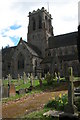
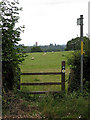
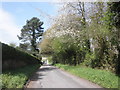
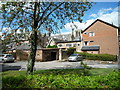
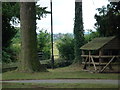
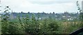
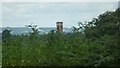
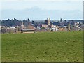
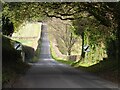
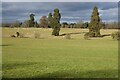
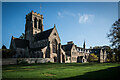
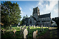
66 photos from this area
Area Information
Key information about the HR2 7ZW including its size, population, and administrative classification.
- Area Type
- Postcode
- Area Size
- 8.8 hectares
- Population
- 1870
- Population Density
- 1657 people/km²
House Prices in HR2 7ZW
42
Properties
£241,241
Average Sold Price
£79,950
Lowest Price
£475,000
Highest Price
Showing 42 properties
| Address | Type | Beds | Baths | Last Sale Price | Last Sale Date | |
|---|---|---|---|---|---|---|
| 111 Dorchester Way, Belmont, HR2 7ZW | Detached | 4 | 2 | £385,000 | Nov 2024 | |
| 67 Dorchester Way, Belmont, HR2 7ZW | Detached | 4 | 2 | £369,500 | Aug 2024 | |
| 115 Dorchester Way, Belmont, HR2 7ZW | Detached | 5 | 4 | £475,000 | May 2024 | |
| 91 Dorchester Way, Belmont, HR2 7ZW | Detached | 4 | 2 | £347,000 | Jan 2024 | |
| 53 Dorchester Way, Belmont, HR2 7ZW | Detached | 3 | 1 | £308,000 | Jul 2023 | |
| 75 Dorchester Way, Belmont, HR2 7ZW | Detached | 4 | - | £360,000 | Jun 2022 | |
| 117 Dorchester Way, Belmont, HR2 7ZW | Detached | 5 | 3 | £350,000 | Mar 2021 | |
| 79 Dorchester Way, Belmont, HR2 7ZW | Detached | 4 | 2 | £365,000 | Feb 2021 | |
| 57 Dorchester Way, Belmont, HR2 7ZW | Detached | 4 | - | £348,000 | Aug 2019 | |
| 113 Dorchester Way, Belmont, HR2 7ZW | Detached | 5 | - | £315,000 | Nov 2016 |
Page 1 of 5
Energy Efficiency in HR2 7ZW
Amenities
Schools
| Rank | School | Type | Entry gender | Ages |
|---|
Explore more schools in this area
Go to Schools tabDemographics
Household Size
Two person
most common
Accommodation Type
Houses
most common
Tenure
69
majority
Ethnic Group
White
most common
Religion
N/A
most common
Household Composition
N/A
most common
Age
47
median
Adults (30-64 years)
most common
Household Deprivation
N/A
with no deprivation
NS-SEC
32
in Lower managerial occupations
Explore more demographic insights in this area
Go to Demographics tabPlanning
Planning Constraints
- Flood RiskPremium
- Ramsar Wetland SitesPremium
- Area of Outstanding Natural BeautyPremium
- Protected Nature ReservePremium
- Protected WoodlandPremium