Area Overview for HR2 7ZP
Photos of HR2 7ZP
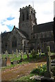
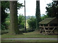
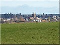
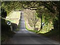
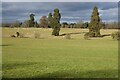
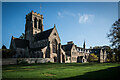
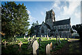
66 photos from this area
Area Information
Key information about the HR2 7ZP including its size, population, and administrative classification.
- Area Type
- Postcode
- Area Size
- 12.7 hectares
- Population
- 1870
- Population Density
- 1657 people/km²
House Prices in HR2 7ZP
69
Properties
£213,698
Average Sold Price
£54,000
Lowest Price
£430,000
Highest Price
Showing 69 properties
| Address | Type | Beds | Baths | Last Sale Price | Last Sale Date | |
|---|---|---|---|---|---|---|
| 136 Dorchester Way, Belmont, HR2 7ZP | Detached | 5 | 3 | £393,750 | Nov 2024 | |
| 74 Dorchester Way, Belmont, HR2 7ZP | house | 4 | 3 | £375,000 | Mar 2024 | |
| 42 Dorchester Way, Belmont, HR2 7ZP | Detached | 4 | 2 | £350,000 | Feb 2024 | |
| 44 Dorchester Way, Belmont, HR2 7ZP | Detached | 3 | 2 | £275,000 | May 2023 | |
| 130 Dorchester Way, Belmont, HR2 7ZP | Detached | 5 | 3 | £430,000 | Jan 2023 | |
| 22 Dorchester Way, Belmont, HR2 7ZP | house | 3 | 2 | £285,000 | Dec 2022 | |
| 116 Dorchester Way, Belmont, HR2 7ZP | house | - | - | £322,000 | Nov 2021 | |
| 132 Dorchester Way, Belmont, HR2 7ZP | Detached | 6 | 3 | £380,000 | Jun 2021 | |
| 26 Dorchester Way, Belmont, HR2 7ZP | Detached | 4 | - | £299,995 | May 2021 | |
| 128 Dorchester Way, Belmont, HR2 7ZP | Detached | 4 | 1 | £325,000 | Apr 2021 |
Page 1 of 7
Energy Efficiency in HR2 7ZP
Amenities
Schools
| Rank | School | Type | Entry gender | Ages |
|---|
Explore more schools in this area
Go to Schools tabDemographics
Household Size
Two person
most common
Accommodation Type
Houses
most common
Tenure
69
majority
Ethnic Group
White
most common
Religion
N/A
most common
Household Composition
N/A
most common
Age
47
median
Adults (30-64 years)
most common
Household Deprivation
N/A
with no deprivation
NS-SEC
32
in Lower managerial occupations
Explore more demographic insights in this area
Go to Demographics tabPlanning
Planning Constraints
- Flood RiskPremium
- Ramsar Wetland SitesPremium
- Area of Outstanding Natural BeautyPremium
- Protected Nature ReservePremium
- Protected WoodlandPremium