Area Overview for HR2 7ZA
Photos of HR2 7ZA
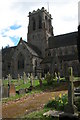
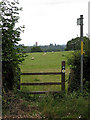
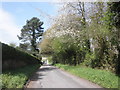
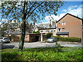
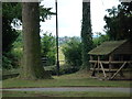
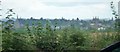
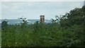
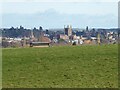
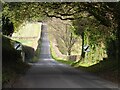
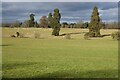
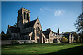
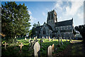
66 photos from this area
Area Information
Key information about the HR2 7ZA including its size, population, and administrative classification.
- Area Type
- Postcode
- Area Size
- 6967 m²
- Population
- 1870
- Population Density
- 1657 people/km²
House Prices in HR2 7ZA
19
Properties
£174,612
Average Sold Price
£51,950
Lowest Price
£255,000
Highest Price
Showing 19 properties
| Address | Type | Beds | Baths | Last Sale Price | Last Sale Date | |
|---|---|---|---|---|---|---|
| 9 Stanbrook Road, Belmont, HR2 7ZA | Terraced | 3 | 1 | £248,000 | Nov 2025 | |
| Wyland, 4 Stanbrook Road, Belmont, HR2 7ZA | Retail | 3 | 2 | £254,000 | Apr 2022 | |
| 17 Stanbrook Road, Belmont, HR2 7ZA | house | 3 | 1 | £234,500 | Mar 2022 | |
| 16 Stanbrook Road, Belmont, HR2 7ZA | Detached | 3 | 2 | £219,000 | Jan 2020 | |
| 1 Stanbrook Road, Belmont, HR2 7ZA | house | - | - | £255,000 | Nov 2019 | |
| 20 Stanbrook Road, Belmont, HR2 7ZA | house | 4 | 3 | £255,000 | Nov 2018 | |
| 6 Stanbrook Road, Belmont, HR2 7ZA | house | - | - | £200,000 | Dec 2015 | |
| 15 Stanbrook Road, Belmont, HR2 7ZA | Terraced | 3 | 1 | £147,000 | May 2014 | |
| 2 Stanbrook Road, Belmont, HR2 7ZA | house | - | - | £205,000 | Feb 2012 | |
| 12 Stanbrook Road, Belmont, HR2 7ZA | house | - | - | £186,450 | Jun 2011 |
Page 1 of 2
Energy Efficiency in HR2 7ZA
Amenities
Schools
| Rank | School | Type | Entry gender | Ages |
|---|
Explore more schools in this area
Go to Schools tabDemographics
Household Size
Two person
most common
Accommodation Type
Houses
most common
Tenure
69
majority
Ethnic Group
White
most common
Religion
N/A
most common
Household Composition
N/A
most common
Age
47
median
Adults (30-64 years)
most common
Household Deprivation
N/A
with no deprivation
NS-SEC
32
in Lower managerial occupations
Explore more demographic insights in this area
Go to Demographics tabPlanning
Planning Constraints
- Flood RiskPremium
- Ramsar Wetland SitesPremium
- Area of Outstanding Natural BeautyPremium
- Protected Nature ReservePremium
- Protected WoodlandPremium