Area Overview for HR2 7JH
Photos of HR2 7JH
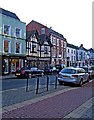
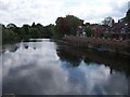
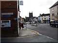
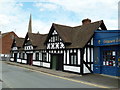
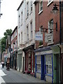
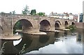
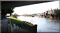
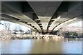
100 photos from this area
Area Information
Key information about the HR2 7JH including its size, population, and administrative classification.
- Area Type
- Postcode
- Area Size
- 1.3 hectares
- Population
- 1484
- Population Density
- 2267 people/km²
House Prices in HR2 7JH
52
Properties
£86,958
Average Sold Price
£37,580
Lowest Price
£147,000
Highest Price
Showing 52 properties
| Address | Type | Beds | Baths | Last Sale Price | Last Sale Date | |
|---|---|---|---|---|---|---|
| 102 Springfield Avenue, Hereford, HR2 7JH | Semi-detached | 3 | 1 | £147,000 | Feb 2019 | |
| 86 Springfield Avenue, Hereford, HR2 7JH | Flat | - | - | £90,000 | Dec 2018 | |
| 60 Springfield Avenue, Hereford, HR2 7JH | Terraced | 3 | 1 | £135,000 | Nov 2017 | |
| 68 Springfield Avenue, Hereford, HR2 7JH | Flat | - | - | £87,500 | Nov 2016 | |
| 2 Springfield Avenue, Hereford, HR2 7JH | Flat | - | - | £55,000 | Nov 2014 | |
| 58 Springfield Avenue, Hereford, HR2 7JH | Terraced | - | - | £135,000 | Apr 2008 | |
| 56 Springfield Avenue, Hereford, HR2 7JH | Terraced | - | - | £88,000 | Mar 2007 | |
| 70 Springfield Avenue, Hereford, HR2 7JH | house | - | - | £51,000 | Jul 2000 | |
| 104 Springfield Avenue, Hereford, HR2 7JH | house | - | - | £43,500 | Jan 1999 | |
| 94 Springfield Avenue, Hereford, HR2 7JH | house | - | - | £37,580 | Feb 1997 |
Page 1 of 6
Energy Efficiency in HR2 7JH
Amenities
Schools
| Rank | School | Type | Entry gender | Ages |
|---|
Explore more schools in this area
Go to Schools tabDemographics
Household Size
One person
most common
Accommodation Type
Houses
most common
Tenure
36
majority
Ethnic Group
White
most common
Religion
N/A
most common
Household Composition
N/A
most common
Age
47
median
Adults (30-64 years)
most common
Household Deprivation
N/A
with no deprivation
NS-SEC
18
in Lower managerial occupations
Explore more demographic insights in this area
Go to Demographics tabPlanning
Planning Constraints
- Flood RiskPremium
- Ramsar Wetland SitesPremium
- Area of Outstanding Natural BeautyPremium
- Protected Nature ReservePremium
- Protected WoodlandPremium