Area Overview for HR2 7JF
Photos of HR2 7JF
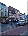
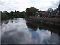
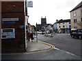
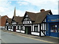
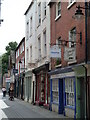
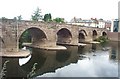
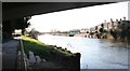
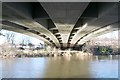
100 photos from this area
Area Information
Key information about the HR2 7JF including its size, population, and administrative classification.
- Area Type
- Postcode
- Area Size
- 3.7 hectares
- Population
- 1484
- Population Density
- 2267 people/km²
House Prices in HR2 7JF
43
Properties
£127,695
Average Sold Price
£73,000
Lowest Price
£189,500
Highest Price
Showing 43 properties
| Address | Type | Beds | Baths | Last Sale Price | Last Sale Date | |
|---|---|---|---|---|---|---|
| 34 Belmont Avenue, Hereford, HR2 7JF | Semi-detached | 3 | 1 | £189,500 | Jun 2025 | |
| 48 Belmont Avenue, Hereford, HR2 7JF | house | - | - | £159,950 | Feb 2025 | |
| 87 Belmont Avenue, Hereford, HR2 7JF | Terraced | 3 | 1 | £167,500 | May 2024 | |
| 52 Belmont Avenue, Hereford, HR2 7JF | house | - | - | £180,000 | Oct 2018 | |
| 28 Belmont Avenue, Hereford, HR2 7JF | house | - | - | £125,000 | Jul 2012 | |
| 24 Belmont Avenue, Hereford, HR2 7JF | house | - | - | £110,000 | Jan 2011 | |
| 83 Belmont Avenue, Hereford, HR2 7JF | house | - | - | £103,000 | Jan 2011 | |
| 85 Belmont Avenue, Hereford, HR2 7JF | house | - | - | £84,000 | Nov 2010 | |
| 89 Belmont Avenue, Hereford, HR2 7JF | Terraced | - | - | £85,000 | Dec 2007 | |
| 54 Belmont Avenue, Hereford, HR2 7JF | house | - | - | £73,000 | Oct 2003 |
Page 1 of 5
Energy Efficiency in HR2 7JF
Amenities
Schools
| Rank | School | Type | Entry gender | Ages |
|---|
Explore more schools in this area
Go to Schools tabDemographics
Household Size
One person
most common
Accommodation Type
Houses
most common
Tenure
36
majority
Ethnic Group
White
most common
Religion
N/A
most common
Household Composition
N/A
most common
Age
47
median
Adults (30-64 years)
most common
Household Deprivation
N/A
with no deprivation
NS-SEC
18
in Lower managerial occupations
Explore more demographic insights in this area
Go to Demographics tabPlanning
Planning Constraints
- Flood RiskPremium
- Ramsar Wetland SitesPremium
- Area of Outstanding Natural BeautyPremium
- Protected Nature ReservePremium
- Protected WoodlandPremium