Area Overview for HR1 4PF
Photos of HR1 4PF


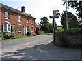


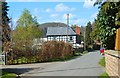
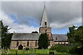
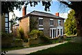
108 photos from this area
Area Information
Key information about the HR1 4PF including its size, population, and administrative classification.
- Area Type
- Postcode
- Area Size
- 7330 m²
- Population
- 2100
- Population Density
- 84 people/km²
House Prices in HR1 4PF
8
Properties
£287,500
Average Sold Price
£105,000
Lowest Price
£420,000
Highest Price
Showing 8 properties
| Address | Type | Beds | Baths | Last Sale Price | Last Sale Date | |
|---|---|---|---|---|---|---|
| Maple House, B 4224 From Fiddlers Green To The Moors, Fownhope, HR1 4PF | Detached | - | - | £420,000 | Jan 2007 | |
| Whiterdine Place, B 4224 From Fiddlers Green To The Moors, Fownhope, HR1 4PF | house | - | - | £250,000 | Oct 2006 | |
| Whiterdine House, B 4224 From Fiddlers Green To The Moors, Fownhope, HR1 4PF | Semi-detached | - | - | £375,000 | Feb 2005 | |
| Walworth House, B 4224 From Fiddlers Green To The Moors, Fownhope, HR1 4PF | Detached | - | - | £105,000 | Sep 1999 | |
| Fownhope Butchers Shop, Walworth House, B 4224 From Fiddlers Green To The Moors, Fownhope, HR1 4PF | undefined | - | - | - | - | |
| Lupins, B 4224 From Fiddlers Green To The Moors, Fownhope, HR1 4PF | Detached | - | - | - | - | |
| The Coach House, Whiterdine House, B 4224 From Fiddlers Green To The Moors, Fownhope, HR1 4PF | Detached | 2 | 1 | - | - | |
| Whiterdine, B 4224 From Fiddlers Green To The Moors, Fownhope, HR1 4PF | Detached | - | - | - | - |
Energy Efficiency in HR1 4PF
Amenities
Schools
| Rank | School | Type | Entry gender | Ages |
|---|
Explore more schools in this area
Go to Schools tabDemographics
Household Size
Two person
most common
Accommodation Type
Houses
most common
Tenure
77
majority
Ethnic Group
White
most common
Religion
N/A
most common
Household Composition
N/A
most common
Age
47
median
Adults (30-64 years)
most common
Household Deprivation
N/A
with no deprivation
NS-SEC
37
in Lower managerial occupations
Explore more demographic insights in this area
Go to Demographics tabPlanning
Planning Constraints
- Flood RiskPremium
- Ramsar Wetland SitesPremium
- Protected Nature ReservePremium
- Protected WoodlandPremium