Area Overview for HR1 4PL
Photos of HR1 4PL
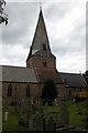
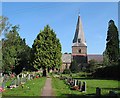

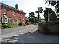
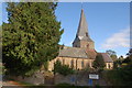
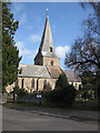
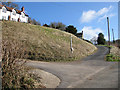
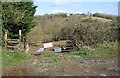
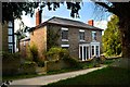
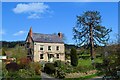
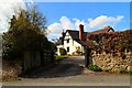
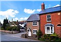
100 photos from this area
Area Information
Key information about the HR1 4PL including its size, population, and administrative classification.
- Area Type
- Postcode
- Area Size
- 3.2 hectares
- Population
- 2100
- Population Density
- 84 people/km²
House Prices in HR1 4PL
71
Properties
£184,636
Average Sold Price
£5,850
Lowest Price
£315,000
Highest Price
Showing 71 properties
| Address | Type | Beds | Baths | Last Sale Price | Last Sale Date | |
|---|---|---|---|---|---|---|
| 15 Church Croft, Fownhope, HR1 4PL | Flat | - | - | £5,850 | Aug 2025 | |
| 17 Church Croft, Fownhope, HR1 4PL | Flat | - | - | £5,850 | Aug 2025 | |
| 59 Church Croft, Fownhope, HR1 4PL | Semi-detached | 3 | 2 | £305,000 | Dec 2024 | |
| 3 Church Croft, Fownhope, HR1 4PL | Semi-detached | 3 | 1 | £250,000 | Mar 2024 | |
| 13 Church Croft, Fownhope, HR1 4PL | Semi-detached | 4 | 2 | £305,000 | Jan 2024 | |
| 60 Church Croft, Fownhope, HR1 4PL | Detached | 3 | 2 | £315,000 | Jun 2023 | |
| 11 Church Croft, Fownhope, HR1 4PL | house | - | - | £270,000 | Sep 2020 | |
| 1 Church Croft, Fownhope, HR1 4PL | Semi-detached | 3 | 1 | £225,000 | Apr 2020 | |
| 67 Church Croft, Fownhope, HR1 4PL | house | - | - | £300,000 | Nov 2018 | |
| 68 Church Croft, Fownhope, HR1 4PL | house | - | - | £289,950 | Apr 2018 |
Page 1 of 8
Energy Efficiency in HR1 4PL
Amenities
Schools
| Rank | School | Type | Entry gender | Ages |
|---|
Explore more schools in this area
Go to Schools tabDemographics
Household Size
Two person
most common
Accommodation Type
Houses
most common
Tenure
77
majority
Ethnic Group
White
most common
Religion
N/A
most common
Household Composition
N/A
most common
Age
47
median
Adults (30-64 years)
most common
Household Deprivation
N/A
with no deprivation
NS-SEC
37
in Lower managerial occupations
Explore more demographic insights in this area
Go to Demographics tabPlanning
Planning Constraints
- Flood RiskPremium
- Ramsar Wetland SitesPremium
- Protected Nature ReservePremium
- Protected WoodlandPremium