Area Overview for HR1 4JU
Photos of HR1 4JU
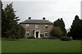
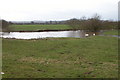
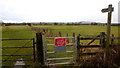

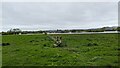

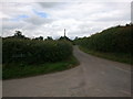
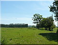
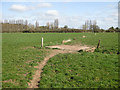
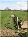
16 photos from this area
Area Information
Key information about the HR1 4JU including its size, population, and administrative classification.
- Area Type
- Postcode
- Area Size
- 1.9 km²
- Population
- 2100
- Population Density
- 84 people/km²
House Prices in HR1 4JU
27
Properties
£302,716
Average Sold Price
£96,000
Lowest Price
£540,000
Highest Price
Showing 27 properties
| Address | Type | Beds | Baths | Last Sale Price | Last Sale Date | |
|---|---|---|---|---|---|---|
| Pippins Lodge, Rectory Road, Hampton Bishop, HR1 4JU | Detached | 4 | 3 | £525,000 | Mar 2021 | |
| Spinnaker, Rectory Road, Hampton Bishop, HR1 4JU | house | - | - | £335,000 | Jan 2021 | |
| Stanford House, Rectory Road, Hampton Bishop, HR1 4JU | house | - | - | £540,000 | Sep 2020 | |
| Sycamore House, Rectory Road, Hampton Bishop, HR1 4JU | house | - | - | £450,000 | Nov 2019 | |
| Derna, Rectory Road, Hampton Bishop, HR1 4JU | Detached | - | - | £325,000 | Mar 2019 | |
| Rose Cottage, Rectory Road, Hampton Bishop, HR1 4JU | house | - | - | £390,000 | Mar 2017 | |
| Cedartop, Rectory Road, Hampton Bishop, HR1 4JU | Detached | 4 | 2 | £421,500 | Feb 2017 | |
| The Skylarks, Rectory Road, Hampton Bishop, HR1 4JU | Bungalow | 3 | 1 | £242,500 | Jul 2016 | |
| Jays Nest, Rectory Road, Hampton Bishop, HR1 4JU | Bungalow | 3 | 2 | £243,000 | Jan 2015 | |
| Ridgeway, Rectory Road, Hampton Bishop, HR1 4JU | Bungalow | 3 | 2 | £245,000 | Aug 2014 |
Page 1 of 3
Energy Efficiency in HR1 4JU
Amenities
Schools
| Rank | School | Type | Entry gender | Ages |
|---|
Explore more schools in this area
Go to Schools tabDemographics
Household Size
Two person
most common
Accommodation Type
Houses
most common
Tenure
77
majority
Ethnic Group
White
most common
Religion
N/A
most common
Household Composition
N/A
most common
Age
47
median
Adults (30-64 years)
most common
Household Deprivation
N/A
with no deprivation
NS-SEC
37
in Lower managerial occupations
Explore more demographic insights in this area
Go to Demographics tabPlanning
Planning Constraints
- Flood RiskPremium
- Ramsar Wetland SitesPremium
- Area of Outstanding Natural BeautyPremium
- Protected Nature ReservePremium
- Protected WoodlandPremium