Area Overview for DY9 9HY
Photos of DY9 9HY
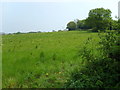
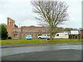
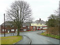
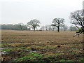
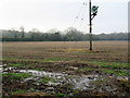
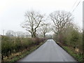
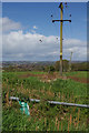
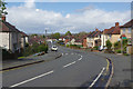

16 photos from this area
Area Information
Key information about the DY9 9HY including its size, population, and administrative classification.
- Area Type
- Postcode
- Area Size
- 7250 m²
- Population
- 1744
- Population Density
- 4536 people/km²
House Prices in DY9 9HY
30
Properties
£101,219
Average Sold Price
£34,250
Lowest Price
£210,000
Highest Price
Showing 30 properties
| Address | Type | Beds | Baths | Last Sale Price | Last Sale Date | |
|---|---|---|---|---|---|---|
| 118 Dobbins Oak Road, Wollescote, DY9 9HY | Semi-detached | 3 | 1 | £210,000 | Jun 2022 | |
| 74A Dobbins Oak Road, Wollescote, DY9 9HY | Maisonette | 2 | 1 | £85,000 | Aug 2020 | |
| 114 Dobbins Oak Road, Wollescote, DY9 9HY | Terraced | 3 | 1 | £165,000 | Jul 2020 | |
| 94 Dobbins Oak Road, Wollescote, DY9 9HY | Terraced | 3 | 1 | £140,000 | Aug 2016 | |
| 116 Dobbins Oak Road, Wollescote, DY9 9HY | house | - | - | £81,000 | May 2011 | |
| 106 Dobbins Oak Road, Wollescote, DY9 9HY | house | - | - | £49,500 | Aug 2000 | |
| 96 Dobbins Oak Road, Wollescote, DY9 9HY | Terraced | - | - | £45,000 | Nov 1996 | |
| 90 Dobbins Oak Road, Wollescote, DY9 9HY | house | - | - | £34,250 | Jun 1995 | |
| 104 Dobbins Oak Road, Wollescote, DY9 9HY | house | - | - | - | - | |
| 92 Dobbins Oak Road, Wollescote, DY9 9HY | Terraced | - | - | - | - |
Page 1 of 3
Energy Efficiency in DY9 9HY
Amenities
Schools
| Rank | School | Type | Entry gender | Ages |
|---|
Explore more schools in this area
Go to Schools tabDemographics
Household Size
Two person
most common
Accommodation Type
Houses
most common
Tenure
37
majority
Ethnic Group
White
most common
Religion
N/A
most common
Household Composition
N/A
most common
Age
47
median
Adults (30-64 years)
most common
Household Deprivation
N/A
with no deprivation
NS-SEC
17
in Lower managerial occupations
Explore more demographic insights in this area
Go to Demographics tabPlanning
Planning Constraints
- Flood RiskPremium
- Ramsar Wetland SitesPremium
- Area of Outstanding Natural BeautyPremium
- Protected Nature ReservePremium
- Protected WoodlandPremium