Area Overview for DY9 9HU
Photos of DY9 9HU
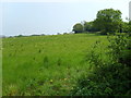

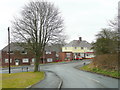
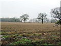
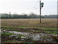
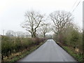
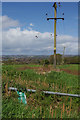
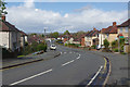
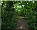
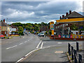

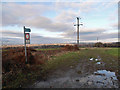
16 photos from this area
Area Information
Key information about the DY9 9HU including its size, population, and administrative classification.
- Area Type
- Postcode
- Area Size
- 1.7 hectares
- Population
- 1744
- Population Density
- 4536 people/km²
House Prices in DY9 9HU
64
Properties
£128,425
Average Sold Price
£24,250
Lowest Price
£185,000
Highest Price
Showing 64 properties
| Address | Type | Beds | Baths | Last Sale Price | Last Sale Date | |
|---|---|---|---|---|---|---|
| 42 Murcroft Road, Wollescote, DY9 9HU | Terraced | 2 | 1 | £180,000 | May 2024 | |
| 72 Murcroft Road, Wollescote, DY9 9HU | house | - | - | £185,000 | Jun 2023 | |
| 40 Murcroft Road, Wollescote, DY9 9HU | Semi-detached | 3 | 1 | £167,500 | Feb 2023 | |
| 34 Murcroft Road, Wollescote, DY9 9HU | Retail | 3 | 1 | £175,500 | Aug 2022 | |
| 52 Murcroft Road, Wollescote, DY9 9HU | Terraced | 2 | 1 | £175,000 | Jul 2022 | |
| 62 Murcroft Road, Wollescote, DY9 9HU | Semi-detached | 3 | 1 | £161,500 | Jun 2021 | |
| 86 Murcroft Road, Wollescote, DY9 9HU | Flat | - | - | £38,750 | May 2021 | |
| 16 Murcroft Road, Wollescote, DY9 9HU | Semi-detached | 3 | 1 | £158,500 | May 2021 | |
| 94 Murcroft Road, Wollescote, DY9 9HU | house | - | - | £162,000 | Dec 2020 | |
| 110 Murcroft Road, Wollescote, DY9 9HU | Terraced | 2 | 1 | £138,000 | Nov 2020 |
Page 1 of 7
Energy Efficiency in DY9 9HU
Amenities
Schools
| Rank | School | Type | Entry gender | Ages |
|---|
Explore more schools in this area
Go to Schools tabDemographics
Household Size
Two person
most common
Accommodation Type
Houses
most common
Tenure
37
majority
Ethnic Group
White
most common
Religion
N/A
most common
Household Composition
N/A
most common
Age
47
median
Adults (30-64 years)
most common
Household Deprivation
N/A
with no deprivation
NS-SEC
17
in Lower managerial occupations
Explore more demographic insights in this area
Go to Demographics tabPlanning
Planning Constraints
- Flood RiskPremium
- Ramsar Wetland SitesPremium
- Area of Outstanding Natural BeautyPremium
- Protected Nature ReservePremium
- Protected WoodlandPremium