Area Overview for DY9 7AZ
Photos of DY9 7AZ
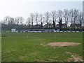
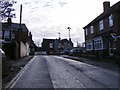
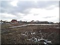
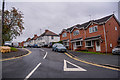
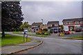
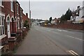
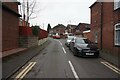
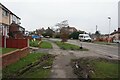
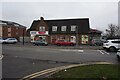
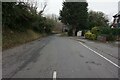
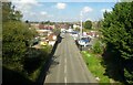
48 photos from this area
Area Information
Key information about the DY9 7AZ including its size, population, and administrative classification.
- Area Type
- Postcode
- Area Size
- 3.0 hectares
- Population
- 1655
- Population Density
- 4424 people/km²
House Prices in DY9 7AZ
46
Properties
£147,366
Average Sold Price
£51,500
Lowest Price
£240,000
Highest Price
Showing 46 properties
| Address | Type | Beds | Baths | Last Sale Price | Last Sale Date | |
|---|---|---|---|---|---|---|
| 3 Grayling Road, Stourbridge, DY9 7AZ | Semi-detached | 3 | 1 | £155,000 | Mar 2024 | |
| 29 Grayling Road, Stourbridge, DY9 7AZ | Semi-detached | 3 | 1 | £235,000 | Dec 2023 | |
| 26 Grayling Road, Stourbridge, DY9 7AZ | Semi-detached | 3 | 1 | £240,000 | Dec 2023 | |
| 23 Grayling Road, Stourbridge, DY9 7AZ | house | - | - | £184,000 | Oct 2019 | |
| 31 Grayling Road, Stourbridge, DY9 7AZ | Semi-detached | 3 | 2 | £175,500 | Mar 2018 | |
| 48 Grayling Road, Stourbridge, DY9 7AZ | Detached | 3 | 1 | £158,000 | Oct 2014 | |
| 12 Grayling Road, Stourbridge, DY9 7AZ | house | 3 | - | £145,950 | Jan 2014 | |
| 22 Grayling Road, Stourbridge, DY9 7AZ | house | - | - | £145,000 | Aug 2013 | |
| 47 Grayling Road, Stourbridge, DY9 7AZ | house | - | - | £149,200 | Mar 2010 | |
| 35 Grayling Road, Stourbridge, DY9 7AZ | Semi-detached | - | - | £149,950 | Jun 2007 |
Page 1 of 5
Energy Efficiency in DY9 7AZ
Amenities
Schools
| Rank | School | Type | Entry gender | Ages |
|---|
Explore more schools in this area
Go to Schools tabDemographics
Household Size
One person
most common
Accommodation Type
Houses
most common
Tenure
57
majority
Ethnic Group
White
most common
Religion
N/A
most common
Household Composition
N/A
most common
Age
47
median
Adults (30-64 years)
most common
Household Deprivation
N/A
with no deprivation
NS-SEC
21
in Lower managerial occupations
Explore more demographic insights in this area
Go to Demographics tabPlanning
Planning Constraints
- Flood RiskPremium
- Ramsar Wetland SitesPremium
- Area of Outstanding Natural BeautyPremium
- Protected Nature ReservePremium
- Protected WoodlandPremium