Area Overview for DY9 0TX
Photos of DY9 0TX

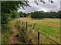
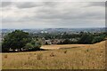
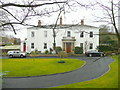
27 photos from this area
Area Information
Key information about the DY9 0TX including its size, population, and administrative classification.
- Area Type
- Postcode
- Area Size
- 6231 m²
- Population
- 1503
- Population Density
- 3288 people/km²
House Prices in DY9 0TX
10
Properties
£309,676
Average Sold Price
£115,000
Lowest Price
£457,000
Highest Price
Showing 10 properties
| Address | Type | Beds | Baths | Last Sale Price | Last Sale Date | |
|---|---|---|---|---|---|---|
| 56 St Peters Road, Pedmore, DY9 0TX | Bungalow | - | - | £310,000 | Aug 2023 | |
| 58 St Peters Road, Pedmore, DY9 0TX | Retail | 3 | 1 | £387,555 | Oct 2022 | |
| 31 St Peters Road, Pedmore, DY9 0TX | house | - | - | £399,950 | Aug 2022 | |
| 50 St Peters Road, Pedmore, DY9 0TX | house | - | - | £308,900 | Sep 2021 | |
| 44 St Peters Road, Pedmore, DY9 0TX | house | - | - | £457,000 | Jan 2021 | |
| 54 St Peters Road, Pedmore, DY9 0TX | Semi-detached | 2 | 1 | £250,000 | Jan 2020 | |
| 46 St Peters Road, Pedmore, DY9 0TX | Detached | - | - | £249,000 | Jun 2005 | |
| 42 St Peters Road, Pedmore, DY9 0TX | Detached | - | - | £115,000 | Aug 1996 | |
| 52 St Peters Road, Pedmore, DY9 0TX | Semi-detached | 3 | 1 | - | - | |
| 48 St Peters Road, Pedmore, DY9 0TX | Detached | - | - | - | - |
Energy Efficiency in DY9 0TX
Amenities
Schools
| Rank | School | Type | Entry gender | Ages |
|---|
Explore more schools in this area
Go to Schools tabDemographics
Household Size
Two person
most common
Accommodation Type
Houses
most common
Tenure
90
majority
Ethnic Group
White
most common
Religion
N/A
most common
Household Composition
N/A
most common
Age
47
median
Adults (30-64 years)
most common
Household Deprivation
N/A
with no deprivation
NS-SEC
51
in Lower managerial occupations
Explore more demographic insights in this area
Go to Demographics tabPlanning
Planning Constraints
- Flood RiskPremium
- Ramsar Wetland SitesPremium
- Area of Outstanding Natural BeautyPremium
- Protected Nature ReservePremium
- Protected WoodlandPremium