Area Overview for DY9 0TT
Photos of DY9 0TT
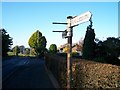
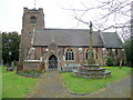


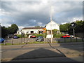
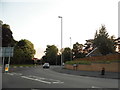


27 photos from this area
Area Information
Key information about the DY9 0TT including its size, population, and administrative classification.
- Area Type
- Postcode
- Area Size
- 7855 m²
- Population
- 1503
- Population Density
- 3288 people/km²
House Prices in DY9 0TT
21
Properties
£255,333
Average Sold Price
£48,000
Lowest Price
£369,500
Highest Price
Showing 21 properties
| Address | Type | Beds | Baths | Last Sale Price | Last Sale Date | |
|---|---|---|---|---|---|---|
| 5 Bank Farm Close, Pedmore, DY9 0TT | house | - | - | £325,000 | Jan 2025 | |
| 2 Bank Farm Close, Pedmore, DY9 0TT | house | - | - | £350,000 | Dec 2024 | |
| 21 Bank Farm Close, Pedmore, DY9 0TT | house | - | - | £322,250 | Nov 2022 | |
| 4 Bank Farm Close, Pedmore, DY9 0TT | Semi-detached | 4 | 1 | £351,250 | Oct 2022 | |
| 3 Bank Farm Close, Pedmore, DY9 0TT | house | - | - | £369,500 | Sep 2020 | |
| 15 Bank Farm Close, Pedmore, DY9 0TT | Bungalow | 3 | 2 | £250,000 | Dec 2018 | |
| 10 Bank Farm Close, Pedmore, DY9 0TT | house | - | - | £285,000 | Jun 2018 | |
| 14 Bank Farm Close, Pedmore, DY9 0TT | house | 3 | - | £228,000 | Sep 2017 | |
| 6 Bank Farm Close, Pedmore, DY9 0TT | house | 3 | - | £265,000 | Apr 2017 | |
| 8 Bank Farm Close, Pedmore, DY9 0TT | Semi-detached | 3 | - | £221,000 | May 2016 |
Page 1 of 3
Energy Efficiency in DY9 0TT
Amenities
Schools
| Rank | School | Type | Entry gender | Ages |
|---|
Explore more schools in this area
Go to Schools tabDemographics
Household Size
Two person
most common
Accommodation Type
Houses
most common
Tenure
90
majority
Ethnic Group
White
most common
Religion
N/A
most common
Household Composition
N/A
most common
Age
47
median
Adults (30-64 years)
most common
Household Deprivation
N/A
with no deprivation
NS-SEC
51
in Lower managerial occupations
Explore more demographic insights in this area
Go to Demographics tabPlanning
Planning Constraints
- Flood RiskPremium
- Ramsar Wetland SitesPremium
- Area of Outstanding Natural BeautyPremium
- Protected Nature ReservePremium
- Protected WoodlandPremium