Area Overview for DY9 0RU
Photos of DY9 0RU
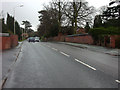
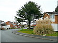
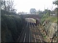
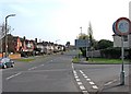
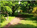
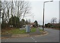
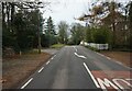
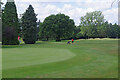
35 photos from this area
Area Information
Key information about the DY9 0RU including its size, population, and administrative classification.
- Area Type
- Postcode
- Area Size
- 1.7 hectares
- Population
- 1653
- Population Density
- 1435 people/km²
House Prices in DY9 0RU
14
Properties
£620,145
Average Sold Price
£249,950
Lowest Price
£900,000
Highest Price
Showing 14 properties
| Address | Type | Beds | Baths | Last Sale Price | Last Sale Date | |
|---|---|---|---|---|---|---|
| 4 Redlake Road, Stourbridge, DY9 0RU | Detached | 2 | 2 | £760,000 | Dec 2022 | |
| 7 Redlake Road, Stourbridge, DY9 0RU | Bungalow | - | - | £720,000 | Mar 2021 | |
| 5 Redlake Road, Stourbridge, DY9 0RU | Detached | 4 | 1 | £900,000 | Mar 2020 | |
| 5B Redlake Road, Stourbridge, DY9 0RU | Bungalow | 4 | 2 | £775,000 | Feb 2020 | |
| Redlake House, 6A Redlake Road, Stourbridge, DY9 0RU | Bungalow | 5 | 3 | £577,500 | Oct 2015 | |
| 3B Redlake Road, Stourbridge, DY9 0RU | house | 4 | - | £450,000 | Jun 2013 | |
| 5A Redlake Road, Stourbridge, DY9 0RU | Bungalow | - | - | £444,000 | Oct 2011 | |
| Greenbanks, 3A Redlake Road, Stourbridge, DY9 0RU | Detached | 5 | 3 | £650,000 | May 2010 | |
| Waverley Court, 2 Redlake Road, Stourbridge, DY9 0RU | Detached | - | - | £675,000 | Jul 2008 | |
| Newman House, Redlake Road, Stourbridge, DY9 0RU | Detached | - | - | £249,950 | Jan 2001 |
Page 1 of 2
Energy Efficiency in DY9 0RU
Amenities
Schools
| Rank | School | Type | Entry gender | Ages |
|---|
Explore more schools in this area
Go to Schools tabDemographics
Household Size
Two person
most common
Accommodation Type
Houses
most common
Tenure
95
majority
Ethnic Group
White
most common
Religion
N/A
most common
Household Composition
N/A
most common
Age
47
median
Adults (30-64 years)
most common
Household Deprivation
N/A
with no deprivation
NS-SEC
50
in Lower managerial occupations
Explore more demographic insights in this area
Go to Demographics tabPlanning
Planning Constraints
- Flood RiskPremium
- Ramsar Wetland SitesPremium
- Area of Outstanding Natural BeautyPremium
- Protected Nature ReservePremium
- Protected WoodlandPremium