Area Overview for DY9 0NH
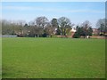
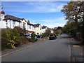
Photos of DY9 0NH


Area Information
DY9 0NH is a compact residential cluster in England, covering 4,082 square metres and home to 2,359 residents. Its population density of 1,710 people per square kilometre suggests a tightly knit community, where daily life is shaped by proximity to amenities and services. The area’s small size means residents are likely to know their neighbours, with a mix of long-term residents and families drawn to its practicality. Nearby schools, rail links, and retail outlets create a self-contained environment, ideal for those prioritising convenience. While the area lacks large-scale infrastructure, its low crime risk and minimal environmental constraints make it appealing for buyers seeking a stable, low-maintenance lifestyle. The presence of multiple schools and accessible transport options also makes it suitable for families, though the predominantly older demographic—median age 47—hints at a community rooted in established routines. For those valuing a quiet, functional living space without the sprawl of larger towns, DY9 0NH offers a blend of practicality and accessibility.
- Area Type
- Postcode
- Area Size
- 4082 m²
- Population
- 2359
- Population Density
- 1710 people/km²
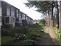
DY9 0NH is predominantly an owner-occupied area, with 86% of residents living in homes they own. This high rate of home ownership suggests a stable market with limited rental activity, making it less attractive to investors seeking short-term returns. The accommodation type is primarily houses, which is unusual for areas with higher population density, indicating a mix of single-family homes and possibly larger properties. This housing stock may appeal to buyers seeking private, spacious living rather than apartments or shared spaces. The small area size and limited surrounding development mean property availability is constrained, potentially driving up prices. For those considering the area, the focus on owner-occupation and house-based living suggests a market suited to families or individuals prioritising long-term residency over flexibility. The lack of rental properties also means buyers should consider whether the area aligns with their need for a primary residence rather than a secondary investment.
House Prices in DY9 0NH
No properties found in this postcode.
Energy Efficiency in DY9 0NH
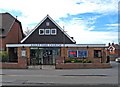
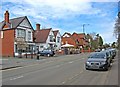
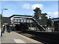
Residents of DY9 0NH have access to a range of nearby amenities, including five retail outlets such as Spar, Co-op Hagley, and M&S Stourbridge BP. These shops provide essentials and convenience, supporting daily errands without the need for long trips. The area’s rail network, with stations like Hagley and Blakedown, connects residents to broader regional services, enhancing mobility. While the data does not specify parks or leisure facilities, the presence of multiple retail and transport options suggests a practical, service-oriented lifestyle. The compact nature of the area means amenities are within walking or short driving distance, reducing the need for extensive travel. For buyers, this implies a neighbourhood where convenience and accessibility are prioritised over sprawling recreational spaces. The mix of retail and rail connectivity makes DY9 0NH appealing to those who value functional, well-served living environments.
Amenities
Schools
Residents of DY9 0NH have access to several schools, including Haybridge High School and Sixth Form, which operates as both a primary school and an academy with a good Ofsted rating. Similarly, Hagley Catholic High School serves as a primary institution and an academy, also rated good. This mix of school types offers families options between traditional primary education and academy-led institutions, which often have distinct curricula or governance structures. The presence of two schools within the area suggests a sufficient capacity to serve local children, reducing the need for long commutes. The good Ofsted ratings indicate that these schools meet or exceed national standards in teaching quality and student outcomes. For families prioritising education, the availability of academies with strong performance ratings could be a decisive factor in choosing DY9 0NH as a home.
| Rank | School | Type | Entry gender | Ages |
|---|
Explore more schools in this area
Go to Schools tabDemographics
The population of DY9 0NH is predominantly adults aged 30–64, with a median age of 47. This suggests a mature, settled community, likely with a strong presence of middle-aged professionals and families. Home ownership is high, with 86% of residents owning their homes, reflecting a stable housing market. The accommodation type is primarily houses, indicating a lack of high-density housing or flats. The predominant ethnic group is White, though no specific data on diversity or deprivation is provided. The age profile and ownership rates suggest a community focused on long-term residency rather than transient populations. For buyers, this demographic profile implies a neighbourhood with established local services and a lower turnover of properties. The absence of detailed diversity data means the area’s cultural composition remains unquantified, but the age range and ownership figures point to a cohesive, low-risk community.
Household Size
Accommodation Type
Tenure
Ethnic Group
Religion
Household Composition
Age
Household Deprivation
NS-SEC
Explore more demographic insights in this area
Go to Demographics tabPlanning
Planning Constraints
- Flood RiskPremium
- Ramsar Wetland SitesPremium
- Area of Outstanding Natural BeautyPremium
- Protected Nature ReservePremium
- Protected WoodlandPremium