Area Overview for DY9 0NP
Photos of DY9 0NP

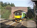
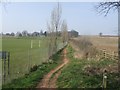
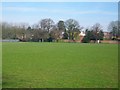
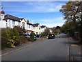
68 photos from this area
Area Information
Key information about the DY9 0NP including its size, population, and administrative classification.
- Area Type
- Postcode
- Area Size
- 9750 m²
- Population
- 2359
- Population Density
- 1710 people/km²
House Prices in DY9 0NP
21
Properties
£353,214
Average Sold Price
£84,500
Lowest Price
£675,000
Highest Price
Showing 21 properties
| Address | Type | Beds | Baths | Last Sale Price | Last Sale Date | |
|---|---|---|---|---|---|---|
| 19 Worcester Close, Hagley, DY9 0NP | Detached | 4 | - | £675,000 | Mar 2024 | |
| 8 Worcester Close, Hagley, DY9 0NP | house | 3 | - | £462,500 | Aug 2023 | |
| 5 Worcester Close, Hagley, DY9 0NP | Semi-detached | 3 | 1 | £367,500 | Jun 2023 | |
| 22 Worcester Close, Hagley, DY9 0NP | house | - | - | £420,000 | Dec 2021 | |
| 18 Worcester Close, Hagley, DY9 0NP | house | - | - | £525,000 | Jun 2021 | |
| 25 Worcester Close, Hagley, DY9 0NP | house | 5 | - | £312,000 | Feb 2021 | |
| 15 Worcester Close, Hagley, DY9 0NP | house | - | - | £350,000 | Feb 2018 | |
| 17 Worcester Close, Hagley, DY9 0NP | Detached | 4 | - | £416,000 | Oct 2015 | |
| 26 Worcester Close, Hagley, DY9 0NP | house | - | - | £235,000 | Sep 2015 | |
| 1 Worcester Close, Hagley, DY9 0NP | house | - | - | £355,000 | Jun 2011 |
Page 1 of 3
Energy Efficiency in DY9 0NP
Amenities
Schools
| Rank | School | Type | Entry gender | Ages |
|---|
Explore more schools in this area
Go to Schools tabDemographics
Household Size
Family (3-5 people)
most common
Accommodation Type
Houses
most common
Tenure
86
majority
Ethnic Group
White
most common
Religion
N/A
most common
Household Composition
N/A
most common
Age
47
median
Adults (30-64 years)
most common
Household Deprivation
N/A
with no deprivation
NS-SEC
53
in Lower managerial occupations
Explore more demographic insights in this area
Go to Demographics tabPlanning
Planning Constraints
- Flood RiskPremium
- Ramsar Wetland SitesPremium
- Area of Outstanding Natural BeautyPremium
- Protected Nature ReservePremium
- Protected WoodlandPremium