Area Overview for DY9 0NB
Photos of DY9 0NB
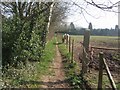
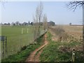
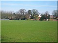
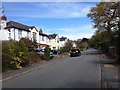
68 photos from this area
Area Information
Key information about the DY9 0NB including its size, population, and administrative classification.
- Area Type
- Postcode
- Area Size
- 1.2 hectares
- Population
- 2359
- Population Density
- 1710 people/km²
House Prices in DY9 0NB
22
Properties
£287,343
Average Sold Price
£75,000
Lowest Price
£580,000
Highest Price
Showing 22 properties
| Address | Type | Beds | Baths | Last Sale Price | Last Sale Date | |
|---|---|---|---|---|---|---|
| 26 Lodge Crescent, Hagley, DY9 0NB | house | - | - | £580,000 | Sep 2022 | |
| 44 Lodge Crescent, Hagley, DY9 0NB | Semi-detached | 3 | 1 | £345,000 | Sep 2017 | |
| 18 Lodge Crescent, Hagley, DY9 0NB | house | - | - | £296,000 | Nov 2016 | |
| 14 Lodge Crescent, Hagley, DY9 0NB | Detached | 4 | - | £425,000 | Aug 2016 | |
| 10 Lodge Crescent, Hagley, DY9 0NB | house | - | - | £317,500 | Jun 2016 | |
| 30 Lodge Crescent, Hagley, DY9 0NB | house | - | - | £425,000 | Dec 2014 | |
| 16 Lodge Crescent, Hagley, DY9 0NB | Semi-detached | 3 | 1 | £315,000 | Aug 2014 | |
| 8 Lodge Crescent, Hagley, DY9 0NB | Semi-detached | 3 | - | £272,000 | Aug 2014 | |
| 12 Lodge Crescent, Hagley, DY9 0NB | Detached | - | - | £330,000 | Aug 2009 | |
| 20 Lodge Crescent, Hagley, DY9 0NB | Detached | - | - | £285,000 | Nov 2008 |
Page 1 of 3
Energy Efficiency in DY9 0NB
Amenities
Schools
| Rank | School | Type | Entry gender | Ages |
|---|
Explore more schools in this area
Go to Schools tabDemographics
Household Size
Family (3-5 people)
most common
Accommodation Type
Houses
most common
Tenure
86
majority
Ethnic Group
White
most common
Religion
N/A
most common
Household Composition
N/A
most common
Age
47
median
Adults (30-64 years)
most common
Household Deprivation
N/A
with no deprivation
NS-SEC
53
in Lower managerial occupations
Explore more demographic insights in this area
Go to Demographics tabPlanning
Planning Constraints
- Flood RiskPremium
- Ramsar Wetland SitesPremium
- Area of Outstanding Natural BeautyPremium
- Protected Nature ReservePremium
- Protected WoodlandPremium