Area Overview for DY8 4JD
Photos of DY8 4JD

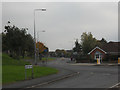
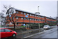
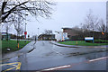
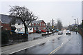
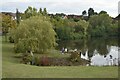

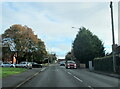
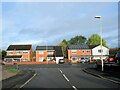
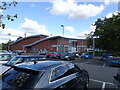
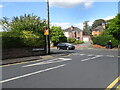
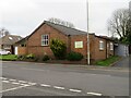
46 photos from this area
Area Information
Key information about the DY8 4JD including its size, population, and administrative classification.
- Area Type
- Postcode
- Area Size
- 1.0 hectares
- Population
- 1510
- Population Density
- 6481 people/km²
House Prices in DY8 4JD
16
Properties
£244,643
Average Sold Price
£54,000
Lowest Price
£346,000
Highest Price
Showing 16 properties
| Address | Type | Beds | Baths | Last Sale Price | Last Sale Date | |
|---|---|---|---|---|---|---|
| 22 Vicarage Road, Amblecote, DY8 4JD | Detached | 3 | 2 | £307,500 | Oct 2025 | |
| 20 Vicarage Road, Amblecote, DY8 4JD | Semi-detached | 2 | 2 | £315,000 | Nov 2023 | |
| 33 Vicarage Road, Amblecote, DY8 4JD | house | - | - | £346,000 | May 2022 | |
| 34 Vicarage Road, Amblecote, DY8 4JD | Semi-detached | 3 | 1 | £230,000 | Nov 2019 | |
| 38 Vicarage Road, Amblecote, DY8 4JD | house | - | - | £320,000 | Apr 2019 | |
| 18 Vicarage Road, Amblecote, DY8 4JD | Flat | 2 | 2 | £265,000 | Oct 2018 | |
| 19 Vicarage Road, Amblecote, DY8 4JD | Detached | 4 | - | £317,500 | Aug 2015 | |
| 16 Vicarage Road, Amblecote, DY8 4JD | house | - | - | £300,000 | Mar 2011 | |
| 21 Vicarage Road, Amblecote, DY8 4JD | Detached | 3 | 1 | £170,000 | Mar 2006 | |
| 40 Vicarage Road, Amblecote, DY8 4JD | Bungalow | - | - | £275,000 | Feb 2006 |
Page 1 of 2
Energy Efficiency in DY8 4JD
Amenities
Schools
| Rank | School | Type | Entry gender | Ages |
|---|
Explore more schools in this area
Go to Schools tabDemographics
Household Size
Family (3-5 people)
most common
Accommodation Type
Houses
most common
Tenure
34
majority
Ethnic Group
White
most common
Religion
N/A
most common
Household Composition
N/A
most common
Age
47
median
Adults (30-64 years)
most common
Household Deprivation
N/A
with no deprivation
NS-SEC
19
in Lower managerial occupations
Explore more demographic insights in this area
Go to Demographics tabPlanning
Planning Constraints
- Flood RiskPremium
- Ramsar Wetland SitesPremium
- Area of Outstanding Natural BeautyPremium
- Protected Nature ReservePremium
- Protected WoodlandPremium