Area Overview for DY4 9BP
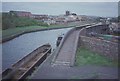
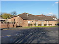
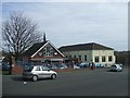
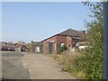
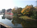
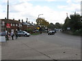
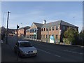
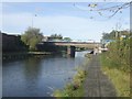
Photos of DY4 9BP
Area Information
Living in DY4 9BP means being part of a tightly knit residential cluster in England, where 1,535 people inhabit just 8,067 square metres. This makes it one of the most densely populated areas in the country, with 190,275 people per square kilometre. The area’s compact size fosters a sense of community, though it also means limited space for expansion. Most residents are adults aged 30–64, reflecting a mature demographic with established routines. The area is predominantly home-owning, with 56% of properties in private hands, and the majority are houses rather than flats. Daily life is shaped by proximity to key services, though the small footprint means residents must balance convenience with the constraints of a high-density environment. The area’s character is defined by its mix of practicality and proximity to transport links, making it a viable choice for those prioritising accessibility over space. However, the high population density and compact layout may not suit those seeking larger living areas or low-traffic environments.
- Area Type
- Postcode
- Area Size
- 8067 m²
- Population
- 1535
- Population Density
- 2665 people/km²
DY4 9BP is a small, predominantly owner-occupied area with 56% of properties in private hands. The housing stock is largely composed of houses, which contrasts with the more common flats in high-density urban areas. This mix suggests a community of long-term residents seeking stability, though the limited size of the area may restrict property choice. The high population density of 190,275 people per square kilometre means that land is scarce, potentially driving up property values or limiting availability. For buyers, this small postcode area offers a focused selection of homes, but proximity to transport links and amenities may be key factors in its appeal. The predominance of houses could make it attractive to families, though the compact footprint may not suit those requiring larger spaces. Buyers should consider the area’s constraints when evaluating long-term suitability.
House Prices in DY4 9BP
Showing 2 properties
| Address | Type | Beds | Baths | Last Sale Price | Last Sale Date | |
|---|---|---|---|---|---|---|
| Black Country Consortium, Grange House, 4 Brick Kiln Street, Tipton, DY4 9BP | Office | - | - | - | - | |
| 1 Brick Kiln Street, Tipton, DY4 9BP | Flat | - | - | - | - |
Energy Efficiency in DY4 9BP
Residents of DY4 9BP have access to a variety of amenities within practical reach, including five retail outlets such as Co-op Upper and Aldi Priory, which cater to everyday shopping needs. The proximity to railway and metro stations, like Dudley Port and Wednesbury Parkway, ensures easy access to regional hubs. While specific parks or leisure facilities are not listed in the data, the area’s density suggests a focus on compact, efficient living rather than expansive recreational spaces. The presence of multiple schools and transport links contributes to a functional lifestyle, though the small footprint may limit options for outdoor activities. The mix of retail and transport infrastructure supports a convenient, accessible daily life, though residents may need to venture slightly further for larger leisure or green spaces.
Amenities
Schools
Residents of DY4 9BP have access to a range of educational institutions, including St Paul’s CofE (C) Primary School, which serves younger children, and Midland Oak School, an independent institution offering alternative education options. Bloomfield School, a special needs school, and St Pauls Church of England Academy, an academy, provide further diversity in schooling. This mix allows families to choose between state, independent, and specialist provisions. The presence of multiple school types reflects the area’s varied educational landscape, though the lack of Ofsted ratings means performance data is not available. Parents may find this range beneficial, but the proximity of these schools to the area is critical for daily commutes. The compact nature of DY4 9BP means that school catchment areas are likely to be tightly defined, requiring careful consideration of location when purchasing property.
| Rank | School | Type | Entry gender | Ages |
|---|
Explore more schools in this area
Go to Schools tabDemographics
DY4 9BP’s population of 1,535 is overwhelmingly composed of adults aged 30–64, with a median age of 47. This suggests a community of middle-aged residents, likely with established careers and families. Home ownership stands at 56%, indicating a stable, long-term resident base, while the remaining 44% are likely renters or in mixed tenure. The area is predominantly occupied by White residents, with no data provided on other ethnic groups. The high proportion of houses over flats suggests a preference for traditional family homes, which may align with the age profile of the population. The density of 190,275 people per square kilometre means limited open space, which could impact quality of life for those valuing privacy or outdoor recreation. However, the compact nature of the area ensures that essential services and amenities are within walking distance, catering to the needs of a mature, settled community.
Household Size
Accommodation Type
Tenure
Ethnic Group
Religion
Household Composition
Age
Household Deprivation
NS-SEC
Explore more demographic insights in this area
Go to Demographics tabPlanning
Planning Constraints
- Flood RiskPremium
- Ramsar Wetland SitesPremium
- Area of Outstanding Natural BeautyPremium
- Protected Nature ReservePremium
- Protected WoodlandPremium