Area Overview for DY4 9BB
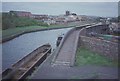
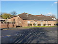
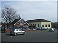
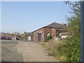
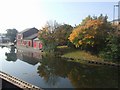
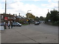
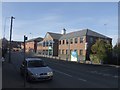
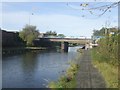
Photos of DY4 9BB
Area Information
DY4 9BB is a compact residential postcode in England, covering just 2.9 hectares and home to 1,535 residents. Its high population density of 53,250 people per square kilometre reflects a tightly packed community, typical of smaller urban clusters. This area is defined by its proximity to essential services and transport links, making it practical for daily life. The demographic profile suggests a mature population, with a median age of 47 and most residents aged between 30 and 64. This age range indicates a mix of established families and professionals, contributing to a stable local economy. While the area lacks expansive green spaces, its density ensures that amenities are within walking distance. The presence of multiple schools, retail outlets, and transport hubs positions DY4 9BB as a convenient base for those prioritising accessibility over open space. However, the small footprint means the community is tightly woven, with limited room for expansion or new developments.
- Area Type
- Postcode
- Area Size
- 2.9 hectares
- Population
- 1535
- Population Density
- 2665 people/km²
The property market in DY4 9BB is characterised by a 56% home ownership rate, with houses being the primary accommodation type. This indicates a community where many residents are homeowners, likely seeking stability in a small, established area. The prevalence of houses over flats suggests a focus on family-friendly living, though the limited area size means housing stock is constrained. Buyers considering this postcode should note that the market is not dominated by rentals, which may affect availability for those seeking short-term lets. The compact nature of DY4 9BB means properties are likely to be in close proximity to each other, with little scope for new developments. For those prioritising location over space, the area offers convenience, but buyers may need to look beyond the immediate postcode for larger options. The high population density also implies competition for properties, particularly in desirable locations near amenities.
House Prices in DY4 9BB
Showing 18 properties
| Address | Type | Beds | Baths | Last Sale Price | Last Sale Date | |
|---|---|---|---|---|---|---|
| 20 Furnace Parade, Tipton, DY4 9BB | Terraced | 3 | 1 | £190,000 | Jun 2025 | |
| 15 Furnace Parade, Tipton, DY4 9BB | Detached | 3 | 1 | £180,000 | Mar 2025 | |
| 19 Furnace Parade, Tipton, DY4 9BB | house | - | - | £182,000 | Sep 2022 | |
| 18 Furnace Parade, Tipton, DY4 9BB | Terraced | 3 | 1 | £116,000 | Jan 2017 | |
| 23 Furnace Parade, Tipton, DY4 9BB | house | - | - | £57,500 | Apr 2015 | |
| 14 Furnace Parade, Tipton, DY4 9BB | Detached | 3 | - | £103,000 | Feb 2013 | |
| 25 Furnace Parade, Tipton, DY4 9BB | Terraced | 3 | 1 | £104,950 | Dec 2005 | |
| 30 Furnace Parade, Tipton, DY4 9BB | house | 3 | 1 | - | - | |
| 31 Furnace Parade, Tipton, DY4 9BB | Detached | - | - | - | - | |
| 24 Furnace Parade, Tipton, DY4 9BB | Terraced | - | - | - | - |
Energy Efficiency in DY4 9BB
Living in DY4 9BB offers a blend of practicality and accessibility, with amenities clustered within walking distance. Retail options include Co-op Upper, Aldi Priory, and Farmfoods Tipton, providing essential shopping and groceries. The presence of multiple rail and metro stations, such as Coseley and Wednesbury Parkway, ensures easy access to broader transport networks. While the area lacks detailed information on parks or leisure facilities, the density of services suggests a focus on convenience over expansive recreational spaces. For residents, this means a lifestyle centred on efficiency, with minimal travel required for daily needs. The proximity to schools, shops, and transport hubs fosters a self-contained community, though those seeking larger green spaces may need to venture further afield. The character of DY4 9BB is defined by its compactness, making it ideal for those prioritising accessibility and ease of movement.
Amenities
Schools
Residents of DY4 9BB have access to a range of educational institutions, including St Paul’s CofE (C) Primary School, which serves younger children, and St Pauls Church of England Academy, an academy school for older students. Midland Oak School, an independent institution, offers alternative educational pathways, while Bloomfield School specialises in supporting students with specific needs. This mix of state, independent, and special schools provides families with diverse options depending on their priorities. The presence of multiple schools within proximity ensures that children have access to education without long commutes. However, the data does not include Ofsted ratings or performance metrics, so prospective families should conduct further research on individual school standards. The variety of school types reflects the area’s commitment to catering to different educational requirements, from mainstream education to specialist support.
| Rank | School | Type | Entry gender | Ages |
|---|
Explore more schools in this area
Go to Schools tabDemographics
The population of DY4 9BB is predominantly adults aged 30–64, with a median age of 47. This suggests a community of settled individuals, many of whom may be in their peak working years or nearing retirement. Home ownership stands at 56%, indicating a mix of owner-occupied properties and rental units. The accommodation type is primarily houses, which may appeal to families seeking more space than flats. The predominant ethnic group is White, though specific diversity statistics are not provided. The high population density of 53,250 people per square kilometre implies a compact living environment, which can foster a strong sense of community but may also limit personal space. For residents, this density means proximity to services but could contribute to a feeling of overcrowding in public areas. The demographic profile suggests a stable, long-term resident base rather than a transient population.
Household Size
Accommodation Type
Tenure
Ethnic Group
Religion
Household Composition
Age
Household Deprivation
NS-SEC
Explore more demographic insights in this area
Go to Demographics tabPlanning
Planning Constraints
- Flood RiskPremium
- Ramsar Wetland SitesPremium
- Area of Outstanding Natural BeautyPremium
- Protected Nature ReservePremium
- Protected WoodlandPremium