Area Overview for DY4 8XB
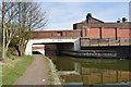
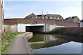
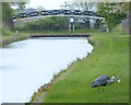
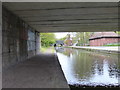
Photos of DY4 8XB


Area Information
Living in DY4 8XB means inhabiting a tightly packed residential cluster in England, where 1,767 people reside across 3,213 square metres. This density creates a compact, possibly bustling environment, though the area’s small size means it is likely a single, cohesive neighbourhood rather than a sprawling suburb. The median age of 47 suggests a mature population, with the majority aged between 30 and 64. This demographic may indicate a stable, established community, possibly with long-standing local ties. The area’s proximity to retail outlets, rail stations, and metro stops ensures practical access to daily essentials and broader connectivity. While the data does not specify local landmarks or cultural hubs, the presence of schools and transport links implies a functional, if modest, urban lifestyle. For buyers, the challenge lies in the area’s limited size, which may restrict property availability but could also foster a close-knit community feel.
- Area Type
- Postcode
- Area Size
- 3213 m²
- Population
- 1767
- Population Density
- 3482 people/km²
The property market in DY4 8XB is characterised by a 42% home ownership rate, suggesting that nearly half of the area’s properties are rented. This mix of owner-occupied and rental homes may indicate a balance between long-term residents and transient tenants. The accommodation type is predominantly houses, which is unusual for a high-density postcode, implying that properties are likely semi-detached or terraced. Given the area’s small size, the housing stock is limited, and buyers may need to consider nearby areas for more options. The focus on houses rather than flats or apartments could appeal to families seeking more space, though the compact nature of the postcode may limit availability. Prospective buyers should weigh the proximity to amenities against the potential scarcity of properties in this specific location.
House Prices in DY4 8XB
Showing 10 properties
| Address | Type | Beds | Baths | Last Sale Price | Last Sale Date | |
|---|---|---|---|---|---|---|
| 31 Coneygree Road, Tipton, DY4 8XB | house | - | - | £120,000 | Oct 2018 | |
| 23 Coneygree Road, Tipton, DY4 8XB | house | - | - | £118,500 | Oct 2015 | |
| 27 Coneygree Road, Tipton, DY4 8XB | house | - | - | £115,000 | Mar 2007 | |
| 19 Coneygree Road, Tipton, DY4 8XB | Terraced | 3 | 1 | - | - | |
| 17 Coneygree Road, Tipton, DY4 8XB | Semi-detached | - | - | - | - | |
| 25 Coneygree Road, Tipton, DY4 8XB | house | - | - | - | - | |
| 21 Coneygree Road, Tipton, DY4 8XB | Terraced | - | - | - | - | |
| 29 Coneygree Road, Tipton, DY4 8XB | Terraced | - | - | - | - | |
| 25A Coneygree Road, Tipton, DY4 8XB | Terraced | - | - | - | - | |
| 31A Coneygree Road, Tipton, DY4 8XB | Detached | - | - | - | - |
Energy Efficiency in DY4 8XB
Residents of DY4 8XB have access to a range of nearby amenities, including five retail outlets such as Morrisons Daily, Co-op Tipton, and Tesco Dudley. These shops provide practical access to groceries and everyday essentials. The area’s rail and metro stations—Dudley Port, Tipton, and Coseley, alongside Black Lake and Dartmouth Street—enhance connectivity for both work and leisure. While the data does not specify parks or leisure facilities, the presence of multiple retail and transport hubs suggests a lifestyle focused on convenience and accessibility. The compact nature of the area may mean that daily life revolves around these immediate amenities, with limited need to travel further for basic needs.
Amenities
Schools
The nearest school to DY4 8XB is Sacred Heart Primary School, which has an Ofsted rating of 'good'. This suggests a reliable educational option for young children, though the data does not list secondary schools or other educational institutions. The presence of a primary school with a positive rating may be a key draw for families, offering a stable start to education. However, the absence of additional schools means parents may need to look further afield for secondary schooling or specialist provision. The single school listed implies a focus on primary education, which could be a limitation for those requiring a full range of educational services within the area.
| Rank | School | Type | Entry gender | Ages |
|---|
Explore more schools in this area
Go to Schools tabDemographics
DY4 8XB has a median age of 47, with the most common age range being adults aged 30 to 64. This suggests a population skewed toward middle-aged individuals, possibly reflecting a mix of long-term residents and families. Home ownership stands at 42%, indicating that nearly half of properties are rented, which may influence the local housing market’s dynamics. The predominant accommodation type is houses, which is uncommon in high-density areas, hinting at a blend of semi-detached or terraced homes. The predominant ethnic group is White, though no further diversity data is provided. With a population density of 549,999 people per square kilometre, the area is exceptionally crowded, which may impact living conditions and community interactions. This density could mean shared spaces and a reliance on nearby amenities for daily life.
Household Size
Accommodation Type
Tenure
Ethnic Group
Religion
Household Composition
Age
Household Deprivation
NS-SEC
Explore more demographic insights in this area
Go to Demographics tabPlanning
Planning Constraints
- Flood RiskPremium
- Ramsar Wetland SitesPremium
- Area of Outstanding Natural BeautyPremium
- Protected Nature ReservePremium
- Protected WoodlandPremium