Area Overview for DY4 8EW
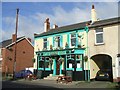
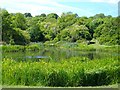
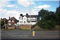
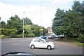
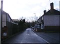
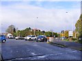
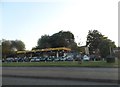
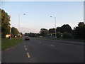
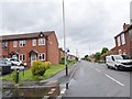
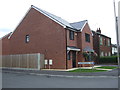
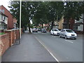
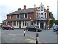
Photos of DY4 8EW
Area Information
DY4 8EW is a small, densely populated postcode area in England, covering 8,055 square metres and home to 1,844 residents. Its compact layout means the community is tightly knit, with services and amenities within close reach. The area’s population density of 228,926 people per square kilometre reflects a high concentration of housing in a limited space, typical of urban or semi-urban settings. The median age of 47 suggests a mature demographic, with the majority of residents falling within the 30-64 age range. This makes DY4 8EW a place where established families and professionals coexist. While the area is small, it is well-connected to nearby towns via rail and metro services, offering a balance of local convenience and broader accessibility. The presence of independent schools and retail options nearby reinforces its appeal to households prioritising proximity to essential services. However, the high density and limited green spaces may influence the character of daily life, with a focus on community interaction and practical living over expansive open spaces.
- Area Type
- Postcode
- Area Size
- 8055 m²
- Population
- 1844
- Population Density
- 2106 people/km²
The property market in DY4 8EW is characterised by a mix of owner-occupied and rental homes, with 35% of residents owning their properties. Given the area’s small size and high population density, the housing stock is likely limited, with a focus on single-family homes. The predominance of houses over flats suggests a preference for detached or semi-detached properties, which may be more common in smaller, residential clusters. However, the lower home ownership rate indicates that a substantial portion of the market is rental-based, potentially attracting tenants seeking proximity to local amenities. Buyers should consider the area’s compact nature and its immediate surroundings, as property availability may be constrained. The lack of data on property prices or development trends means the market’s dynamics remain opaque, but the presence of nearby transport links and schools could enhance its appeal to families and commuters.
House Prices in DY4 8EW
Showing 18 properties
| Address | Type | Beds | Baths | Last Sale Price | Last Sale Date | |
|---|---|---|---|---|---|---|
| 18 Sefton Close, Tipton, DY4 8EW | house | - | - | £213,750 | Feb 2024 | |
| 2 Sefton Close, Tipton, DY4 8EW | house | - | - | - | - | |
| 15 Sefton Close, Tipton, DY4 8EW | Semi-detached | 3 | 2 | - | - | |
| 7 Sefton Close, Tipton, DY4 8EW | Semi-detached | 3 | 2 | - | - | |
| 11 Sefton Close, Tipton, DY4 8EW | house | - | - | - | - | |
| 19 Sefton Close, Tipton, DY4 8EW | house | 3 | 2 | - | - | |
| 17 Sefton Close, Tipton, DY4 8EW | Terraced | 3 | 2 | - | - | |
| 16 Sefton Close, Tipton, DY4 8EW | house | - | - | - | - | |
| 3 Sefton Close, Tipton, DY4 8EW | Semi-detached | 3 | 2 | - | - | |
| 9 Sefton Close, Tipton, DY4 8EW | house | - | - | - | - |
Energy Efficiency in DY4 8EW
Living in DY4 8EW offers access to a range of practical amenities within walking or short driving distance. Retail options include Aldi Priory, Co-op Woodsetton, and Morrisons Daily Dudley, providing essential grocery and household services. The area’s proximity to rail and metro stations—such as Tipton, Coseley, and Wednesbury Parkway—ensures convenient travel for work, shopping, or leisure. While the data does not specify parks or leisure facilities, the compact layout suggests that residents may rely on nearby town centres for recreational activities. The presence of multiple retail and transport hubs contributes to a functional, community-focused lifestyle, where daily needs are met without the need for long commutes. However, the lack of detailed information on green spaces or cultural amenities means the area’s character beyond practicality remains less defined.
Amenities
Schools
The nearest school to DY4 8EW is Rathbone Choices, an independent institution. Independent schools are typically fee-paying and may offer specialised curricula or smaller class sizes compared to state-run schools. However, no Ofsted rating or academic performance data is provided, so prospective families must rely on other factors when evaluating the school’s quality. The absence of state schools in the immediate vicinity means the area may cater more to households prioritising private education. For families requiring state-funded options, the nearest schools would likely be located in nearby towns, necessitating a commute. The presence of a single independent school highlights the need for further research into local educational provision, though the data does not specify additional schools or their types.
| Rank | School | Type | Entry gender | Ages |
|---|
Explore more schools in this area
Go to Schools tabDemographics
The community in DY4 8EW is predominantly composed of adults aged 30-64, with a median age of 47. This suggests a population that is largely settled, with fewer young families or retirees compared to other areas. Home ownership rates are relatively low at 35%, indicating that a significant portion of the housing stock is rented out, which may reflect the area’s compact size and limited property availability. The predominant accommodation type is houses, though the exact number of flats or other property types is not specified. The population is overwhelmingly White, with no data provided on other ethnic groups. The high population density of 228,926 people per square kilometre means living spaces are closely packed, which can impact privacy and outdoor space. This density also implies a reliance on shared community resources and local infrastructure, rather than private amenities.
Household Size
Accommodation Type
Tenure
Ethnic Group
Religion
Household Composition
Age
Household Deprivation
NS-SEC
Explore more demographic insights in this area
Go to Demographics tabPlanning
Planning Constraints
- Flood RiskPremium
- Ramsar Wetland SitesPremium
- Area of Outstanding Natural BeautyPremium
- Protected Nature ReservePremium
- Protected WoodlandPremium