Area Overview for DY4 8AL
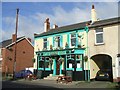
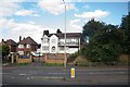
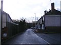
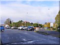
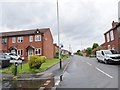
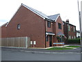
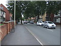
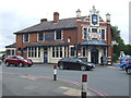
Photos of DY4 8AL


Area Information
DY4 8AL is a compact residential postcode in England, covering just 1.7 hectares and home to 1,868 residents. Its high population density of 107,283 people per square kilometre reflects a tightly knit community, where proximity to amenities and transport links is a defining feature. This small area is part of a broader residential cluster, offering a mix of convenience and quiet living. Residents benefit from nearby retail options, rail services, and metro stops, making daily life efficient. The area’s safety profile is strong, with a low crime risk score of 73 and no significant environmental hazards like flood zones or protected natural sites. While the population is small, the density ensures a lively, interconnected neighbourhood. For those seeking a balance between urban accessibility and residential comfort, DY4 8AL provides a practical base, with homes primarily in single-family structures. Its appeal lies in its manageable size, ease of access to transport, and the absence of major planning constraints that could complicate development or living.
- Area Type
- Postcode
- Area Size
- 1.7 hectares
- Population
- 1868
- Population Density
- 7154 people/km²
DY4 8AL is characterised by a housing stock dominated by single-family homes, with 52% of properties owned by residents. This suggests a market skewed towards owner-occupation rather than rental, though the exact proportion of rental properties is not specified. Given the area’s small size and high density, the housing stock is likely limited in scale, with fewer new developments. Buyers should consider that the compact nature of the postcode may mean competition for properties, particularly as the area is near transport hubs and retail centres. The prevalence of houses over flats indicates a focus on traditional, possibly larger homes, which could appeal to families or those seeking more space. However, the limited data on property types or price ranges means prospective buyers should investigate local listings for specifics on availability and value.
House Prices in DY4 8AL
Showing 62 properties
| Address | Type | Beds | Baths | Last Sale Price | Last Sale Date | |
|---|---|---|---|---|---|---|
| 23 Oxford Way, Tipton, DY4 8AL | Semi-detached | 3 | 2 | £242,000 | Feb 2025 | |
| 26 Oxford Way, Tipton, DY4 8AL | Flat | 2 | 1 | £112,000 | Dec 2024 | |
| 40 Oxford Way, Tipton, DY4 8AL | Semi-detached | 5 | 2 | £340,000 | Sep 2024 | |
| 31 Oxford Way, Tipton, DY4 8AL | Semi-detached | 3 | 2 | £247,500 | Apr 2024 | |
| 45 Oxford Way, Tipton, DY4 8AL | Detached | 2 | 1 | £167,000 | Feb 2024 | |
| 48 Oxford Way, Tipton, DY4 8AL | Semi-detached | 3 | 2 | £225,000 | Nov 2023 | |
| 2 Oxford Way, Tipton, DY4 8AL | Semi-detached | 3 | 1 | £234,000 | Sep 2023 | |
| 7 Oxford Way, Tipton, DY4 8AL | Terraced | 3 | 1 | £240,000 | May 2023 | |
| 49 Oxford Way, Tipton, DY4 8AL | Semi-detached | 2 | - | £170,000 | Nov 2022 | |
| 1 Oxford Way, Tipton, DY4 8AL | Terraced | 2 | 2 | £235,500 | May 2022 |
Energy Efficiency in DY4 8AL
Living in DY4 8AL offers access to a range of practical amenities within close reach. Retail options include Aldi Priory, Co-op Woodsetton, and Morrisons Daily Dudley, providing everyday shopping needs without the need to travel far. The area’s transport links are a key asset, with rail stations like Tipton, Coseley, and Dudley Port offering connections to broader networks, while metro stops at Bradley Lane, Loxdale, and Wednesbury Parkway provide additional flexibility. These stations make commuting to nearby employment centres or leisure destinations straightforward. The compact nature of the postcode means that daily life is efficient, with minimal travel required for essentials. While there is no mention of parks or recreational spaces in the data, the absence of planning constraints like protected woodlands or AONB designations suggests that development prioritises residential and commercial use over natural areas. This balance of retail, transport, and residential living creates a functional, community-focused lifestyle.
Amenities
Schools
| Rank | School | Type | Entry gender | Ages |
|---|
Explore more schools in this area
Go to Schools tabDemographics
The community in DY4 8AL is predominantly composed of adults aged 30–64, with a median age of 47. This suggests a mature, stable population, likely with established careers and family structures. Home ownership stands at 52%, indicating a mix of owner-occupied properties and rental units. The area’s accommodation is largely composed of houses, reflecting a preference for single-family living over flats or apartments. The predominant ethnic group is White, with no data provided on other demographics. The population density, while high, does not necessarily indicate deprivation; it highlights a concentrated, possibly family-oriented community. For residents, this profile implies a neighbourhood with a focus on long-term residency, where schools, local services, and transport are likely prioritised to meet the needs of working-age adults and families.
Household Size
Accommodation Type
Tenure
Ethnic Group
Religion
Household Composition
Age
Household Deprivation
NS-SEC
Explore more demographic insights in this area
Go to Demographics tabPlanning
Planning Constraints
- Flood RiskPremium
- Ramsar Wetland SitesPremium
- Area of Outstanding Natural BeautyPremium
- Protected Nature ReservePremium
- Protected WoodlandPremium