Area Overview for DY2 9LE
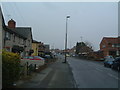
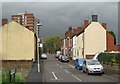
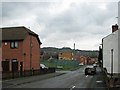
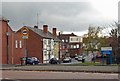
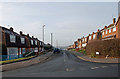
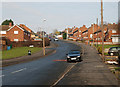
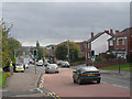
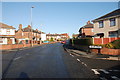
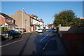
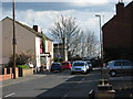
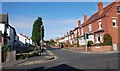
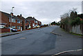
Photos of DY2 9LE
Area Information
DY2 9LE is a compact residential postcode in England, covering just 1.2 hectares and home to 1,551 residents. Its small size means it’s a tightly knit community, with a population density of 126,066 people per square kilometre — a reflection of its clustered housing stock. The area is characterised by a mature demographic, with a median age of 47 and most residents falling within the 30-64 age range. This suggests a stable, established population, likely with long-term ties to the local area. Daily life here is shaped by proximity to transport links and retail hubs, with five nearby supermarkets and multiple rail and metro stations within reach. While the area lacks natural reserves or protected landscapes, its safety profile is mixed: flood risk is negligible, but crime rates sit at a medium level, requiring standard security measures. For those seeking a quiet, well-connected suburb with practical amenities, DY2 9LE offers a blend of convenience and community.
- Area Type
- Postcode
- Area Size
- 1.2 hectares
- Population
- 1551
- Population Density
- 4979 people/km²
DY2 9LE is primarily an owner-occupied area, with 61% of properties in private hands. The housing stock is dominated by houses, which suggests a focus on family homes and traditional residential architecture. This contrasts with areas where flats or apartments predominate, indicating a different dynamic for buyers. The small size of the postcode — just 1.2 hectares — means the property market is highly localised, with limited scope for expansion or new developments. For buyers, this could mean competition for existing homes, but also a stable market with established values. The high population density, combined with the prevalence of houses, suggests a demand for space within a compact area. Those considering purchase should note the area’s proximity to transport links and retail amenities, which may enhance property appeal despite its small footprint.
House Prices in DY2 9LE
Showing 2 properties
| Address | Type | Beds | Baths | Last Sale Price | Last Sale Date | |
|---|---|---|---|---|---|---|
| Advinia Health Care, Netherton Green Care Home, Bowling Green Road, Netherton, DY2 9LE | Retirement | - | - | £3,699,509 | Aug 2017 | |
| Guest Flat, Netherton Green Residential And Nursing Home, Bowling Green Road, Netherton, DY2 9LE | hotel | - | - | - | - |
Energy Efficiency in DY2 9LE
Living in DY2 9LE means having access to a range of nearby amenities that cater to daily needs. Retail options include major supermarkets like Aldi Saltwells, Lidl Netherton, and Asda Netherton, ensuring residents can shop for essentials without traveling far. The area’s transport network is robust, with five rail stations and three metro stops within practical reach, connecting residents to nearby towns and cities. While specific parks or leisure facilities are not detailed in the data, the proximity to rail and metro links suggests easy access to larger recreational areas. The compact nature of the postcode means amenities are closely clustered, reducing travel time for errands or socialising. This convenience, combined with a stable community, creates a lifestyle that balances practicality with accessibility for families and professionals.
Amenities
Schools
| Rank | School | Type | Entry gender | Ages |
|---|
Explore more schools in this area
Go to Schools tabDemographics
The community in DY2 9LE is predominantly composed of adults aged 30-64, with a median age of 47. This suggests a population largely in their prime working years, likely with established careers and family ties. Home ownership is strong, with 61% of properties owner-occupied, indicating a stable housing market. The area is dominated by houses rather than flats, reflecting a preference for traditional, family-friendly dwellings. The predominant ethnic group is White, though specific data on diversity or deprivation is not provided. The high population density — 126,066 people per square kilometre — implies a compact, efficient use of space, typical of smaller postcode areas. For residents, this density translates to a tightly woven community where local amenities and services are within easy reach, though it may also mean limited green space or open areas.
Household Size
Accommodation Type
Tenure
Ethnic Group
Religion
Household Composition
Age
Household Deprivation
NS-SEC
Explore more demographic insights in this area
Go to Demographics tabPlanning
Planning Constraints
- Flood RiskPremium
- Ramsar Wetland SitesPremium
- Area of Outstanding Natural BeautyPremium
- Protected Nature ReservePremium
- Protected WoodlandPremium