Area Overview for DY2 9LX
Photos of DY2 9LX
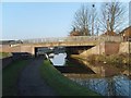
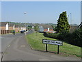
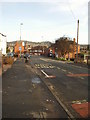
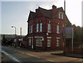
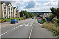
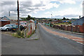
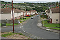
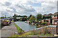
63 photos from this area
Area Information
Key information about the DY2 9LX including its size, population, and administrative classification.
- Area Type
- Postcode
- Area Size
- 1.9 hectares
- Population
- 1551
- Population Density
- 4979 people/km²
House Prices in DY2 9LX
52
Properties
£123,247
Average Sold Price
£26,000
Lowest Price
£210,000
Highest Price
Showing 52 properties
| Address | Type | Beds | Baths | Last Sale Price | Last Sale Date | |
|---|---|---|---|---|---|---|
| 14 Marlow Close, Netherton, DY2 9LX | Semi-detached | 3 | 1 | £106,000 | Mar 2024 | |
| 34 Marlow Close, Netherton, DY2 9LX | house | - | - | £194,000 | Jan 2024 | |
| 19 Marlow Close, Netherton, DY2 9LX | Semi-detached | 3 | 1 | £187,000 | Apr 2023 | |
| 40 Marlow Close, Netherton, DY2 9LX | house | - | - | £210,000 | Nov 2021 | |
| 37 Marlow Close, Netherton, DY2 9LX | house | - | - | £166,000 | Sep 2021 | |
| 41 Marlow Close, Netherton, DY2 9LX | Semi-detached | 4 | 2 | £195,000 | Nov 2020 | |
| 50 Marlow Close, Netherton, DY2 9LX | Semi-detached | 3 | 1 | £138,000 | Mar 2020 | |
| 2 Marlow Close, Netherton, DY2 9LX | Semi-detached | 3 | 1 | £172,000 | Nov 2019 | |
| 30 Marlow Close, Netherton, DY2 9LX | Semi-detached | 3 | 1 | £155,000 | Jul 2019 | |
| 52 Marlow Close, Netherton, DY2 9LX | house | - | - | £120,000 | Nov 2018 |
Page 1 of 6
Energy Efficiency in DY2 9LX
Amenities
Schools
| Rank | School | Type | Entry gender | Ages |
|---|
Explore more schools in this area
Go to Schools tabDemographics
Household Size
Family (3-5 people)
most common
Accommodation Type
Houses
most common
Tenure
61
majority
Ethnic Group
White
most common
Religion
N/A
most common
Household Composition
N/A
most common
Age
47
median
Adults (30-64 years)
most common
Household Deprivation
N/A
with no deprivation
NS-SEC
18
in Lower managerial occupations
Explore more demographic insights in this area
Go to Demographics tabPlanning
Planning Constraints
- Flood RiskPremium
- Ramsar Wetland SitesPremium
- Area of Outstanding Natural BeautyPremium
- Protected Nature ReservePremium
- Protected WoodlandPremium