Area Overview for DY11 6RW
Photos of DY11 6RW
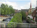
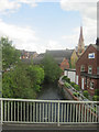
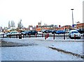
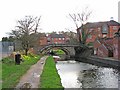
100 photos from this area
Area Information
Key information about the DY11 6RW including its size, population, and administrative classification.
- Area Type
- Postcode
- Area Size
- 2984 m²
- Population
- 1665
- Population Density
- 3743 people/km²
House Prices in DY11 6RW
18
Properties
£102,692
Average Sold Price
£43,000
Lowest Price
£142,000
Highest Price
Showing 18 properties
| Address | Type | Beds | Baths | Last Sale Price | Last Sale Date | |
|---|---|---|---|---|---|---|
| 19 Crescent Road, Kidderminster, DY11 6RW | house | - | - | £140,000 | Aug 2019 | |
| 21 Crescent Road, Kidderminster, DY11 6RW | Terraced | 3 | 1 | £125,000 | Jun 2018 | |
| 20 Crescent Road, Kidderminster, DY11 6RW | Terraced | 3 | 2 | £142,000 | Apr 2018 | |
| 30 Crescent Road, Kidderminster, DY11 6RW | Terraced | 3 | 1 | £124,000 | Dec 2017 | |
| 22 Crescent Road, Kidderminster, DY11 6RW | Terraced | 3 | - | £110,000 | Dec 2015 | |
| 28 Crescent Road, Kidderminster, DY11 6RW | Semi-detached | 3 | - | £125,000 | Jan 2014 | |
| 23 Crescent Road, Kidderminster, DY11 6RW | house | - | - | £118,000 | Dec 2011 | |
| 31 Crescent Road, Kidderminster, DY11 6RW | Terraced | 3 | 1 | £104,000 | Jul 2006 | |
| 27 Crescent Road, Kidderminster, DY11 6RW | Terraced | - | - | £120,000 | Aug 2004 | |
| 24 Crescent Road, Kidderminster, DY11 6RW | house | - | - | £74,000 | Jul 2001 |
Page 1 of 2
Energy Efficiency in DY11 6RW
Amenities
Schools
| Rank | School | Type | Entry gender | Ages |
|---|
Explore more schools in this area
Go to Schools tabDemographics
Household Size
Two person
most common
Accommodation Type
Houses
most common
Tenure
67
majority
Ethnic Group
White
most common
Religion
N/A
most common
Household Composition
N/A
most common
Age
47
median
Adults (30-64 years)
most common
Household Deprivation
N/A
with no deprivation
NS-SEC
27
in Lower managerial occupations
Explore more demographic insights in this area
Go to Demographics tabPlanning
Planning Constraints
- Flood RiskPremium
- Ramsar Wetland SitesPremium
- Area of Outstanding Natural BeautyPremium
- Protected Nature ReservePremium
- Protected WoodlandPremium