Area Overview for DY11 6RJ
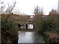
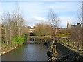
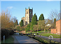
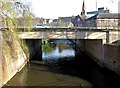
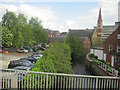
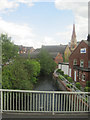
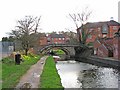
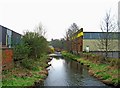
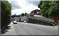
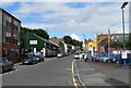
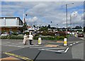
Photos of DY11 6RJ

Area Information
Living in DY11 6RJ means being part of a tightly knit, small-scale residential cluster in England. The area covers just 3.8 hectares, housing 1,395 people in a densely populated setting. This is a place where daily life is shaped by proximity to amenities and a strong focus on community. The high population density—36,243 people per square kilometre—suggests a compact, possibly mixed-use layout, though the data does not specify land use beyond residential. Residents here are likely to find themselves within walking distance of essential services, though the area’s small size means it is not a sprawling suburb. The presence of multiple primary schools nearby hints at a family-oriented demographic, while the predominantly White population and median age of 47 suggest a stable, mature community. For those considering a home here, the area offers a quiet, contained environment with limited expansion, making it ideal for those seeking a settled, localised lifestyle.
- Area Type
- Postcode
- Area Size
- 3.8 hectares
- Population
- 1395
- Population Density
- 4358 people/km²
The property market in DY11 6RJ is characterised by high home ownership—76% of residents own their homes—suggesting a stable, long-term market with limited rental activity. The accommodation type is predominantly houses, which is unusual for an area of this small size. This implies that properties here are likely to be spacious relative to the footprint, possibly with gardens or other private outdoor spaces. The high ownership rate indicates that buyers may find a strong sense of community and established neighbourhoods, though the area’s compact nature means there is little scope for new development. For those considering a home here, the focus on owner-occupied housing means competition for available properties could be fierce, and the market may cater more to existing residents than newcomers.
House Prices in DY11 6RJ
Showing 7 properties
| Address | Type | Beds | Baths | Last Sale Price | Last Sale Date | |
|---|---|---|---|---|---|---|
| Former Nurses Home, Kidderminster General Hospital, Bewdley Road, Kidderminster, DY11 6RJ | Flat | - | - | - | - | |
| Former, 66 Bewdley Road, Kidderminster, DY11 6RJ | Terraced | - | - | - | - | |
| Former, 61 Bewdley Road, Kidderminster, DY11 6RJ | Terraced | - | - | - | - | |
| Former, 63 Bewdley Road, Kidderminster, DY11 6RJ | Terraced | - | - | - | - | |
| Former, 67 Bewdley Road, Kidderminster, DY11 6RJ | Terraced | - | - | - | - | |
| Herefordshire And Worcestershire Health And Care Nhs Trust, The Robertson Centre, Kidderminster General Hospital, Bewdley Road, Kidderminster, DY11 6RJ | commercial | - | - | - | - | |
| D Block, Kidderminster General Hospital, Bewdley Road, Kidderminster, DY11 6RJ | commercial | - | - | - | - |
Energy Efficiency in DY11 6RJ
The lifestyle in DY11 6RJ is shaped by its proximity to retail and transport hubs. Nearby amenities include Tesco Bewdley, Spar, and M&S Kidderminster, offering a range of shopping options within practical reach. These retail outlets suggest the area is well-connected to larger commercial centres, allowing residents to access daily necessities without long commutes. The rail network, with stations at Kidderminster, Blakedown, and Hartlebury, provides access to broader regional connectivity, though the area itself lacks large-scale leisure or recreational facilities. The absence of parks or green spaces in the data means the character of daily life is likely defined by the immediate residential and commercial environment, with a focus on convenience and proximity to services.
Amenities
Schools
DY11 6RJ is served by three primary schools: The Sutton Park First School, Sutton Park Community Primary School, and Sutton Park Primary School, which holds an outstanding Ofsted rating. This concentration of primary education options suggests the area is well-suited for families with young children, offering multiple choices for schooling. The presence of an outstanding-rated school indicates a high standard of education in the vicinity, which could be a key draw for homebuyers prioritising quality schooling. However, the data does not specify secondary schools or higher education options, so families requiring comprehensive schooling may need to look beyond the immediate area. The proximity of these schools to residential properties likely enhances the area’s appeal to parents seeking convenience and educational quality.
| Rank | School | Type | Entry gender | Ages |
|---|
Explore more schools in this area
Go to Schools tabDemographics
The population of DY11 6RJ is predominantly adults aged 30–64, with a median age of 47. This indicates a mature, established community where most residents are likely to be in their prime working or retirement years. Home ownership is high at 76%, suggesting a stable housing market with a focus on long-term residency rather than rental turnover. The accommodation type is predominantly houses, which aligns with the area’s small size and density—each property likely occupies a significant portion of the 3.8-hectare footprint. The predominant ethnic group is White, though no specific data on diversity or deprivation is provided. The absence of detailed socioeconomic breakdowns means assumptions about quality of life must be tempered, but the high home ownership rate and low crime risk (68/100) imply a relatively secure, self-sufficient community.
Household Size
Accommodation Type
Tenure
Ethnic Group
Religion
Household Composition
Age
Household Deprivation
NS-SEC
Explore more demographic insights in this area
Go to Demographics tabPlanning
Planning Constraints
- Flood RiskPremium
- Ramsar Wetland SitesPremium
- Area of Outstanding Natural BeautyPremium
- Protected Nature ReservePremium
- Protected WoodlandPremium